Angres geodata
Angres (Hauts-de-France) is a populated place; located in France in Europe/Paris (GMT+2) time zone. With population of 4,553 people, there are 2168 cities with bigger population in this country. Compared to other cities in France, 96.5% of cities are located further ↓South; 54.4% of cities are located further ←West and 77% of cities have higher elevation than Angres. Note1
Administrative division(s):
- Level 1: Hauts-de-France
- Level 2: Pas-de-Calais
- Level 3: Arrondissement de Lens
- Level 4: Angres


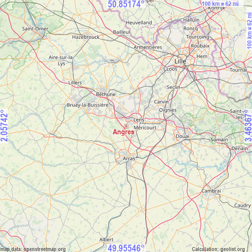
Angres GPS coordinates[2]
50° 24' 20.592" North, 2° 45' 37.944" East
| Map corner | latitude | longitude |
|---|---|---|
| Upper-left | 50.85174°, | 2.05742° |
| Center: | 50.40572°, | 2.76054° |
| Lower-right: | 49.95546°, | 3.46367° |
| Map W x H: | 99.7×99.7 km | = 62×62mi |
| max Lat: | 51.07786° ⇑3.5% North |
| Angres: | 50.40572° |
| min Lat: | ⇓96.5% South 41.3874° |
| min Long | Angres | max Long |
| -5.08615° | 2.76054° | 9.52242° |
| W 54.4%⇐ | ⇒45.6% E |
Elevation
Elevation of Angres is 62 m = 203 ft, and this is 131.7 m = 432 ft below average elevation for this country.
| Max E: |
2333 m = 7654 ft | 77% |
| Avg. | 193.7 m = 635 ft | |
| Angres | 62 m = 203 ft | |
Min E: |
-1 m = -3 ft | 23% |
See also: France elevation on elevation.city.
Geographical zone
Angres is located in North temperate zone (between Tropic of Cancer and the Arctic Circle). Distance of this North polar circle is 1796.6 km =1116.4 mi to North.| Distance of | km | miles | from Angres |
|---|---|---|---|
| North Pole | 4402.5 | 2735.6 | to North |
| Arctic Circle | 1796.6 | 1116.4 | to North |
| Tropic Cancer | 2998.7 | 1863.3 | to South |
| Equator | 5604.6 | 3482.5 | to South |


Nearby cities:
15 places around Angres: (largest is in red/bold)
• Ablain-Saint-Nazaire
3.9 km =2.4 mi,  249°
249°
• Aix-Noulette
4.5 km =2.8 mi,  299°
299°
• Avion
5 km =3.1 mi,  84°
84°
• Bully-les-Mines
4.9 km =3 mi,  330°
330°
• Carency
5 km =3.1 mi,  233°
233°
• Givenchy-en-Gohelle
1.9 km =1.2 mi,  151°
151°
• Grenay
4.9 km =3 mi,  352°
352°
• Lens
5.7 km =3.5 mi,  57°
57°
• Liévin
2.1 km =1.3 mi,  42°
42°
• Loos-en-Gohelle
6.2 km =3.9 mi,  21°
21°
• Neuville-Saint-Vaast
5.4 km =3.4 mi,  178°
178°
• Souchez
2 km =1.2 mi, 225°
• Thélus
6.4 km =4 mi, 153°
• Vimy
5.1 km =3.2 mi,  136°
136°
• Éleu-dit-Leauwette
4 km =2.5 mi, 63°
Sources, notices
• [Note1] Compared only with cities in France existing in our database
• [Src1] Map data: © OpenStreetMap contributors (CC-BY-SA)
• [Src2] Other city data from geonames.org with taken over terms of usage.
• [Src3] Geographical zone / Annual Mean Temperature by Robert A. Rohde @ Wikipedia
