Montfaucon geodata
Montfaucon (Occitanie) is a populated place; located in France in Europe/Paris (GMT+2) time zone. With population of 1,300 people, there are 7031 cities with bigger population in this country. Compared to other cities in France, 86.5% of cities are located further ↑North; 74.4% of cities are located further ←West and 89.5% of cities have higher elevation than Montfaucon. Note1
Administrative division(s):
- Level 1: Occitanie
- Level 2: Gard
- Level 3: Arrondissement de Nîmes
- Level 4: Montfaucon


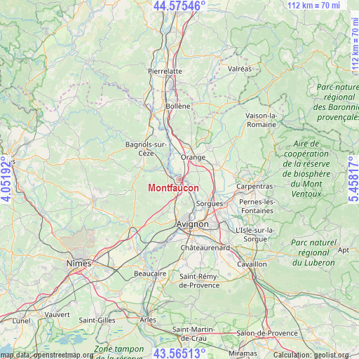
Montfaucon GPS coordinates[2]
44° 4' 20.82" North, 4° 45' 18.144" East
| Map corner | latitude | longitude |
|---|---|---|
| Upper-left | 44.57546°, | 4.05192° |
| Center: | 44.07245°, | 4.75504° |
| Lower-right: | 43.56513°, | 5.45817° |
| Map W x H: | 112.3×112.3 km | = 69.8×69.8mi |
| max Lat: | 51.07786° ⇑86.5% North |
| Montfaucon: | 44.07245° |
| min Lat: | ⇓13.5% South 41.3874° |
| min Long | Montfaucon | max Long |
| -5.08615° | 4.75504° | 9.52242° |
| W 74.4%⇐ | ⇒25.6% E |
Elevation
Elevation of Montfaucon is 31 m = 102 ft, and this is 162.7 m = 534 ft below average elevation for this country.
| Max E: |
2333 m = 7654 ft | 89.5% |
| Avg. | 193.7 m = 635 ft | |
| Montfaucon | 31 m = 102 ft | |
Min E: |
-1 m = -3 ft | 10.5% |
See also: France elevation on elevation.city.
Geographical zone
Montfaucon is located in North temperate zone (between Tropic of Cancer and the Arctic Circle). Distance of this Northern Tropic circle is 2294.5 km =1425.7 mi to South.| Distance of | km | miles | from Montfaucon |
|---|---|---|---|
| North Pole | 5106.7 | 3173.2 | to North |
| Arctic Circle | 2500.8 | 1553.9 | to North |
| Tropic Cancer | 2294.5 | 1425.7 | to South |
| Equator | 4900.4 | 3045 | to South |


Nearby cities:
15 places around Montfaucon: (largest is in red/bold)
• Caderousse
3.4 km =2.1 mi,  2°
2°
• Chusclan
10.3 km =6.4 mi,  325°
325°
• Châteauneuf-du-Pape
6.4 km =4 mi,  106°
106°
• Codolet
7.3 km =4.5 mi,  321°
321°
• Laudun-l'Ardoise
7.7 km =4.8 mi,  293°
293°
• Lirac
6.8 km =4.2 mi,  233°
233°
• Orange
8.5 km =5.3 mi,  31°
31°
• Orsan
9.7 km =6 mi,  312°
312°
• Pujaut
7.8 km =4.8 mi,  167°
167°
• Roquemaure
3.1 km =1.9 mi,  145°
145°
• Saint-Geniès-de-Comolas
2.8 km =1.7 mi,  255°
255°
• Saint-Laurent-des-Arbres
4.8 km =3 mi,  246°
246°
• Saint-Victor-la-Coste
9.1 km =5.7 mi, 263°
• Sauveterre
6.3 km =3.9 mi, 150°
• Tavel
8 km =5 mi,  214°
214°
Sources, notices
• [Note1] Compared only with cities in France existing in our database
• [Src1] Map data: © OpenStreetMap contributors (CC-BY-SA)
• [Src2] Other city data from geonames.org with taken over terms of usage.
• [Src3] Geographical zone / Annual Mean Temperature by Robert A. Rohde @ Wikipedia
