Lirac geodata
Lirac (Occitanie) is a populated place; located in France in Europe/Paris (GMT+2) time zone. With population of 808 people, there are 10506 cities with bigger population in this country. Compared to other cities in France, 86.8% of cities are located further ↑North; 73.6% of cities are located further ←West and 50.1% of cities have lower elevation than Lirac. Note1
Administrative division(s):
- Level 1: Occitanie
- Level 2: Gard
- Level 3: Arrondissement de Nîmes
- Level 4: Lirac


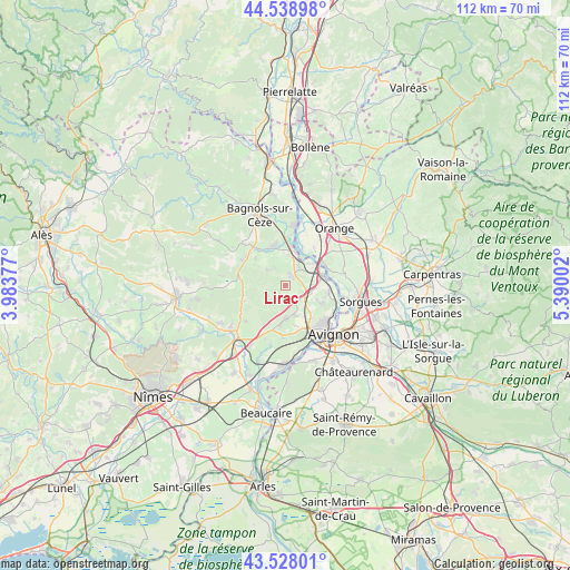
Lirac GPS coordinates[2]
44° 2' 8.34" North, 4° 41' 12.804" East
| Map corner | latitude | longitude |
|---|---|---|
| Upper-left | 44.53898°, | 3.98377° |
| Center: | 44.03565°, | 4.68689° |
| Lower-right: | 43.52801°, | 5.39002° |
| Map W x H: | 112.4×112.4 km | = 69.8×69.8mi |
| max Lat: | 51.07786° ⇑86.8% North |
| Lirac: | 44.03565° |
| min Lat: | ⇓13.2% South 41.3874° |
| min Long | Lirac | max Long |
| -5.08615° | 4.68689° | 9.52242° |
| W 73.6%⇐ | ⇒26.4% E |
Elevation
Elevation of Lirac is 132 m = 433 ft, and this is 61.7 m = 202 ft below average elevation for this country.
| Max E: |
2333 m = 7654 ft | 49.9% |
| Avg. | 193.7 m = 635 ft | |
| Lirac | 132 m = 433 ft | |
Min E: |
-1 m = -3 ft | 50.1% |
See also: France elevation on elevation.city.
Geographical zone
Lirac is located in North temperate zone (between Tropic of Cancer and the Arctic Circle). Distance of this Northern Tropic circle is 2290.4 km =1423.2 mi to South.| Distance of | km | miles | from Lirac |
|---|---|---|---|
| North Pole | 5110.8 | 3175.7 | to North |
| Arctic Circle | 2504.9 | 1556.5 | to North |
| Tropic Cancer | 2290.4 | 1423.2 | to South |
| Equator | 4896.3 | 3042.4 | to South |


Nearby cities:
15 places around Lirac: (largest is in red/bold)
• Caderousse
9.4 km =5.8 mi,  36°
36°
• Codolet
9.8 km =6.1 mi,  5°
5°
• Connaux
9.5 km =5.9 mi,  308°
308°
• Gaujac
10.1 km =6.3 mi,  300°
300°
• Laudun-l'Ardoise
7.3 km =4.5 mi,  347°
347°
• Montfaucon
6.8 km =4.2 mi,  53°
53°
• Pujaut
7.9 km =4.9 mi,  116°
116°
• Rochefort-du-Gard
6.6 km =4.1 mi,  177°
177°
• Roquemaure
7.4 km =4.6 mi,  78°
78°
• Saint-Geniès-de-Comolas
4.4 km =2.7 mi, 39°
• Saint-Laurent-des-Arbres
2.4 km =1.5 mi,  26°
26°
• Saint-Paul-les-Fonts
7.9 km =4.9 mi, 312°
• Saint-Victor-la-Coste
4.7 km =2.9 mi, 310°
• Sauveterre
8.6 km =5.3 mi,  99°
99°
• Tavel
2.7 km =1.7 mi,  160°
160°
Sources, notices
• [Note1] Compared only with cities in France existing in our database
• [Src1] Map data: © OpenStreetMap contributors (CC-BY-SA)
• [Src2] Other city data from geonames.org with taken over terms of usage.
• [Src3] Geographical zone / Annual Mean Temperature by Robert A. Rohde @ Wikipedia
