Mollégès geodata
Mollégès (Provence-Alpes-Côte d'Azur) is a populated place; located in France in Europe/Paris (GMT+2) time zone. With population of 2,280 people, there are 4229 cities with bigger population in this country. Compared to other cities in France, 89% of cities are located further ↑North; 77.1% of cities are located further ←West and 79% of cities have higher elevation than Mollégès. Note1
Administrative division(s):
- Level 1: Provence-Alpes-Côte d'Azur
- Level 2: Département des Bouches-du-Rhône
- Level 3: Arles
- Level 4: Mollégès


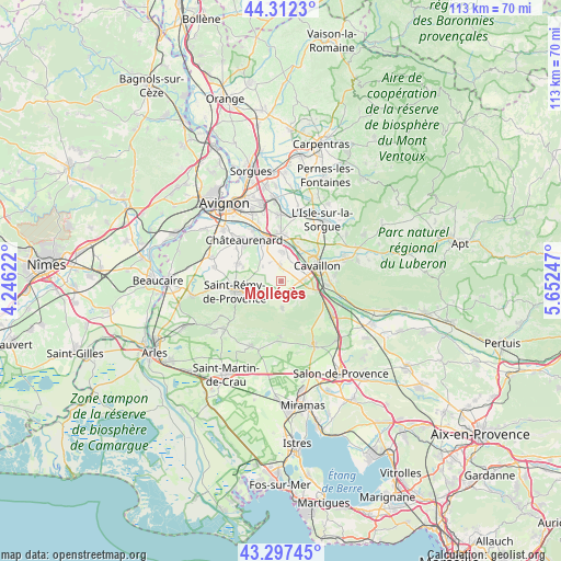
Mollégès GPS coordinates[2]
43° 48' 25.308" North, 4° 56' 57.624" East
| Map corner | latitude | longitude |
|---|---|---|
| Upper-left | 44.3123°, | 4.24622° |
| Center: | 43.80703°, | 4.94934° |
| Lower-right: | 43.29745°, | 5.65247° |
| Map W x H: | 112.8×112.8 km | = 70.1×70.1mi |
| max Lat: | 51.07786° ⇑89% North |
| Mollégès: | 43.80703° |
| min Lat: | ⇓11% South 41.3874° |
| min Long | Mollégès | max Long |
| -5.08615° | 4.94934° | 9.52242° |
| W 77.1%⇐ | ⇒22.9% E |
Elevation
Elevation of Mollégès is 57 m = 187 ft, and this is 136.7 m = 448 ft below average elevation for this country.
| Max E: |
2333 m = 7654 ft | 79% |
| Avg. | 193.7 m = 635 ft | |
| Mollégès | 57 m = 187 ft | |
Min E: |
-1 m = -3 ft | 21% |
See also: France elevation on elevation.city.
Geographical zone
Mollégès is located in North temperate zone (between Tropic of Cancer and the Arctic Circle). Distance of this Northern Tropic circle is 2265 km =1407.4 mi to South.| Distance of | km | miles | from Mollégès |
|---|---|---|---|
| North Pole | 5136.2 | 3191.5 | to North |
| Arctic Circle | 2530.3 | 1572.3 | to North |
| Tropic Cancer | 2265 | 1407.4 | to South |
| Equator | 4870.9 | 3026.6 | to South |


Nearby cities:
15 places around Mollégès: (largest is in red/bold)
• Aureille
11 km =6.8 mi,  180°
180°
• Cabannes
5.9 km =3.7 mi,  2°
2°
• Caumont-sur-Durance
9.6 km =6 mi,  359°
359°
• Cavaillon
7.4 km =4.6 mi,  68°
68°
• Cheval-Blanc
9.1 km =5.7 mi,  93°
93°
• Châteaurenard
11.2 km =7 mi,  317°
317°
• Eygalières
5.1 km =3.2 mi, 179°
• Eyragues
9.4 km =5.8 mi,  293°
293°
• Noves
8.7 km =5.4 mi,  334°
334°
• Orgon
7.4 km =4.6 mi,  103°
103°
• Saint-Andiol
3.1 km =1.9 mi,  352°
352°
• Saint-Rémy-de-Provence
9.7 km =6 mi,  257°
257°
• Sénas
12.5 km =7.8 mi,  124°
124°
• Taillades
11.7 km =7.3 mi, 73°
• Verquières
4.4 km =2.7 mi, 326°
Sources, notices
• [Note1] Compared only with cities in France existing in our database
• [Src1] Map data: © OpenStreetMap contributors (CC-BY-SA)
• [Src2] Other city data from geonames.org with taken over terms of usage.
• [Src3] Geographical zone / Annual Mean Temperature by Robert A. Rohde @ Wikipedia
