Molineuf geodata
Molineuf (Centre) is a populated place; located in France in Europe/Paris (GMT+2) time zone. With population of 838 people, there are 10207 cities with bigger population in this country. Compared to other cities in France, 52.3% of cities are located further ↓South; 66.5% of cities are located further →East and 66.6% of cities have higher elevation than Molineuf. Note1
Administrative division(s):
- Level 1: Centre
- Level 2: Département du Loir-et-Cher
- Level 3: Arrondissement de Blois
- Level 4: Valencisse


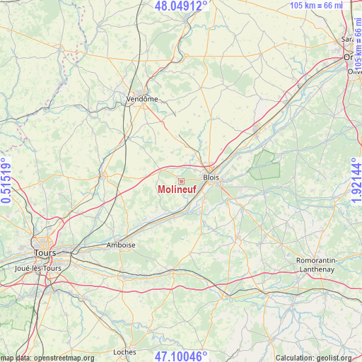
Molineuf GPS coordinates[2]
47° 34' 36.984" North, 1° 13' 5.916" East
| Map corner | latitude | longitude |
|---|---|---|
| Upper-left | 48.04912°, | 0.51519° |
| Center: | 47.57694°, | 1.21831° |
| Lower-right: | 47.10046°, | 1.92144° |
| Map W x H: | 105.5×105.5 km | = 65.6×65.6mi |
| max Lat: | 51.07786° ⇑47.7% North |
| Molineuf: | 47.57694° |
| min Lat: | ⇓52.3% South 41.3874° |
| min Long | Molineuf | max Long |
| -5.08615° | 1.21831° | 9.52242° |
| W 33.5%⇐ | ⇒66.5% E |
Elevation
Elevation of Molineuf is 86 m = 282 ft, and this is 107.7 m = 353 ft below average elevation for this country.
| Max E: |
2333 m = 7654 ft | 66.6% |
| Avg. | 193.7 m = 635 ft | |
| Molineuf | 86 m = 282 ft | |
Min E: |
-1 m = -3 ft | 33.4% |
See also: France elevation on elevation.city.
Geographical zone
Molineuf is located in North temperate zone (between Tropic of Cancer and the Arctic Circle). Distance of this North polar circle is 2111.1 km =1311.8 mi to North.| Distance of | km | miles | from Molineuf |
|---|---|---|---|
| North Pole | 4717 | 2931 | to North |
| Arctic Circle | 2111.1 | 1311.8 | to North |
| Tropic Cancer | 2684.1 | 1667.8 | to South |
| Equator | 5290.1 | 3287.1 | to South |


Nearby cities:
15 places around Molineuf: (largest is in red/bold)
• Blois
8.5 km =5.3 mi,  76°
76°
• Candé-sur-Beuvron
9.6 km =6 mi,  161°
161°
• Chailles
8.1 km =5 mi,  119°
119°
• Chambon-sur-Cisse
1.6 km =1 mi,  187°
187°
• Chouzy-sur-Cisse
6.1 km =3.8 mi, 159°
• Fossé
8 km =5 mi,  38°
38°
• Herbault
6.7 km =4.2 mi,  297°
297°
• Landes-le-Gaulois
9 km =5.6 mi,  343°
343°
• Marolles
10.3 km =6.4 mi, 39°
• Onzain
9.1 km =5.7 mi,  199°
199°
• Orchaise
2.1 km =1.3 mi,  316°
316°
• Saint-Gervais-la-Forêt
10.3 km =6.4 mi,  96°
96°
• Saint-Lubin-en-Vergonnois
4.2 km =2.6 mi,  16°
16°
• Saint-Sulpice-de-Pommeray
4.4 km =2.7 mi,  54°
54°
• Villebarou
9.4 km =5.8 mi,  56°
56°
Sources, notices
• [Note1] Compared only with cities in France existing in our database
• [Src1] Map data: © OpenStreetMap contributors (CC-BY-SA)
• [Src2] Other city data from geonames.org with taken over terms of usage.
• [Src3] Geographical zone / Annual Mean Temperature by Robert A. Rohde @ Wikipedia
