Marolles geodata
Marolles (Centre) is a populated place; located in France in Europe/Paris (GMT+2) time zone. With population of 748 people, there are 11184 cities with bigger population in this country. Compared to other cities in France, 53.4% of cities are located further ↓South; 65.5% of cities are located further →East and 56.9% of cities have higher elevation than Marolles. Note1
Administrative division(s):
- Level 1: Centre
- Level 2: Département du Loir-et-Cher
- Level 3: Arrondissement de Blois
- Level 4: Marolles


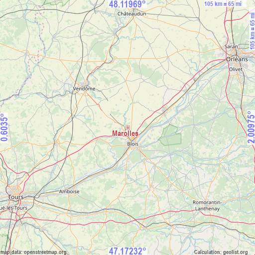
Marolles GPS coordinates[2]
47° 38' 53.34" North, 1° 18' 23.832" East
| Map corner | latitude | longitude |
|---|---|---|
| Upper-left | 48.11969°, | 0.6035° |
| Center: | 47.64815°, | 1.30662° |
| Lower-right: | 47.17232°, | 2.00975° |
| Map W x H: | 105.3×105.3 km | = 65.4×65.4mi |
| max Lat: | 51.07786° ⇑46.6% North |
| Marolles: | 47.64815° |
| min Lat: | ⇓53.4% South 41.3874° |
| min Long | Marolles | max Long |
| -5.08615° | 1.30662° | 9.52242° |
| W 34.5%⇐ | ⇒65.5% E |
Elevation
Elevation of Marolles is 111 m = 364 ft, and this is 82.7 m = 271 ft below average elevation for this country.
| Max E: |
2333 m = 7654 ft | 56.9% |
| Avg. | 193.7 m = 635 ft | |
| Marolles | 111 m = 364 ft | |
Min E: |
-1 m = -3 ft | 43.1% |
See also: France elevation on elevation.city.
Geographical zone
Marolles is located in North temperate zone (between Tropic of Cancer and the Arctic Circle). Distance of this North polar circle is 2103.2 km =1306.9 mi to North.| Distance of | km | miles | from Marolles |
|---|---|---|---|
| North Pole | 4709.1 | 2926.1 | to North |
| Arctic Circle | 2103.2 | 1306.9 | to North |
| Tropic Cancer | 2692.1 | 1672.8 | to South |
| Equator | 5298 | 3292 | to South |


Nearby cities:
15 places around Marolles: (largest is in red/bold)
• Averdon
4.1 km =2.5 mi,  347°
347°
• Blois
6.2 km =3.9 mi,  164°
164°
• Champigny-en-Beauce
8.2 km =5.1 mi,  330°
330°
• Fossé
2.4 km =1.5 mi,  226°
226°
• La Chapelle-Vendômoise
5.7 km =3.5 mi,  296°
296°
• La Chaussée-Saint-Victor
5.8 km =3.6 mi,  127°
127°
• Landes-le-Gaulois
9.2 km =5.7 mi,  274°
274°
• Menars
7.6 km =4.7 mi,  94°
94°
• Saint-Claude-de-Diray
9.1 km =5.7 mi,  112°
112°
• Saint-Denis-sur-Loire
6.6 km =4.1 mi, 113°
• Saint-Lubin-en-Vergonnois
6.7 km =4.2 mi, 234°
• Saint-Sulpice-de-Pommeray
6.1 km =3.8 mi,  209°
209°
• Villebarou
3 km =1.9 mi, 156°
• Villerbon
5.2 km =3.2 mi,  71°
71°
• Vineuil
8.8 km =5.5 mi,  143°
143°
Sources, notices
• [Note1] Compared only with cities in France existing in our database
• [Src1] Map data: © OpenStreetMap contributors (CC-BY-SA)
• [Src2] Other city data from geonames.org with taken over terms of usage.
• [Src3] Geographical zone / Annual Mean Temperature by Robert A. Rohde @ Wikipedia
