Villebarou geodata
Villebarou (Centre) is a populated place; located in France in Europe/Paris (GMT+2) time zone. With population of 2,341 people, there are 4121 cities with bigger population in this country. Compared to other cities in France, 53% of cities are located further ↓South; 65.3% of cities are located further →East and 55.2% of cities have higher elevation than Villebarou. Note1
Administrative division(s):
- Level 1: Centre
- Level 2: Département du Loir-et-Cher
- Level 3: Arrondissement de Blois
- Level 4: Villebarou


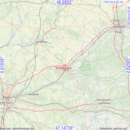
Villebarou GPS coordinates[2]
47° 37' 24.384" North, 1° 19' 21.072" East
| Map corner | latitude | longitude |
|---|---|---|
| Upper-left | 48.0952°, | 0.61939° |
| Center: | 47.62344°, | 1.32252° |
| Lower-right: | 47.14738°, | 2.02565° |
| Map W x H: | 105.4×105.4 km | = 65.5×65.5mi |
| max Lat: | 51.07786° ⇑47% North |
| Villebarou: | 47.62344° |
| min Lat: | ⇓53% South 41.3874° |
| min Long | Villebarou | max Long |
| -5.08615° | 1.32252° | 9.52242° |
| W 34.7%⇐ | ⇒65.3% E |
Elevation
Elevation of Villebarou is 116 m = 381 ft, and this is 77.7 m = 255 ft below average elevation for this country.
| Max E: |
2333 m = 7654 ft | 55.2% |
| Avg. | 193.7 m = 635 ft | |
| Villebarou | 116 m = 381 ft | |
Min E: |
-1 m = -3 ft | 44.8% |
See also: France elevation on elevation.city.
Geographical zone
Villebarou is located in North temperate zone (between Tropic of Cancer and the Arctic Circle). Distance of this North polar circle is 2105.9 km =1308.5 mi to North.| Distance of | km | miles | from Villebarou |
|---|---|---|---|
| North Pole | 4711.8 | 2927.8 | to North |
| Arctic Circle | 2105.9 | 1308.5 | to North |
| Tropic Cancer | 2689.3 | 1671.1 | to South |
| Equator | 5295.2 | 3290.3 | to South |


Nearby cities:
15 places around Villebarou: (largest is in red/bold)
• Averdon
7 km =4.3 mi,  342°
342°
• Blois
3.3 km =2.1 mi,  171°
171°
• Chailles
9.1 km =5.7 mi,  184°
184°
• Fossé
3.1 km =1.9 mi,  291°
291°
• La Chapelle-Vendômoise
8.2 km =5.1 mi,  310°
310°
• La Chaussée-Saint-Victor
3.5 km =2.2 mi,  103°
103°
• Marolles
3 km =1.9 mi, 336°
• Menars
6.7 km =4.2 mi,  71°
71°
• Saint-Claude-de-Diray
7.2 km =4.5 mi, 96°
• Saint-Denis-sur-Loire
4.9 km =3 mi,  88°
88°
• Saint-Gervais-la-Forêt
6.7 km =4.2 mi,  158°
158°
• Saint-Lubin-en-Vergonnois
6.7 km =4.2 mi,  260°
260°
• Saint-Sulpice-de-Pommeray
4.9 km =3 mi,  238°
238°
• Villerbon
5.7 km =3.5 mi,  40°
40°
• Vineuil
6 km =3.7 mi,  137°
137°
Sources, notices
• [Note1] Compared only with cities in France existing in our database
• [Src1] Map data: © OpenStreetMap contributors (CC-BY-SA)
• [Src2] Other city data from geonames.org with taken over terms of usage.
• [Src3] Geographical zone / Annual Mean Temperature by Robert A. Rohde @ Wikipedia
