Moliets-et-Maa geodata
Moliets-et-Maa (Nouvelle-Aquitaine) is a populated place; located in France in Europe/Paris (GMT+2) time zone. With population of 659 people, there are 12396 cities with bigger population in this country. Compared to other cities in France, 88.6% of cities are located further ↑North; 91.2% of cities are located further →East and 95% of cities have higher elevation than Moliets-et-Maa. Note1
Administrative division(s):
- Level 1: Nouvelle-Aquitaine
- Level 2: Landes
- Level 3: Arrondissement de Dax
- Level 4: Moliets-et-Maa


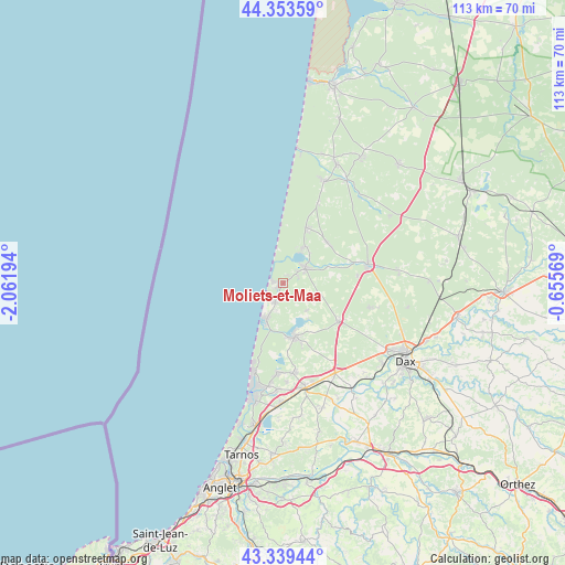
Moliets-et-Maa GPS coordinates[2]
43° 50' 55.212" North, 1° 21' 31.716" West
| Map corner | latitude | longitude |
|---|---|---|
| Upper-left | 44.35359°, | -2.06194° |
| Center: | 43.84867°, | -1.35881° |
| Lower-right: | 43.33944°, | -0.65569° |
| Map W x H: | 112.8×112.8 km | = 70.1×70.1mi |
| max Lat: | 51.07786° ⇑88.6% North |
| Moliets-et-Maa: | 43.84867° |
| min Lat: | ⇓11.4% South 41.3874° |
| min Long | Moliets-et-Maa | max Long |
| -5.08615° | -1.35881° | 9.52242° |
| W 8.8%⇐ | ⇒91.2% E |
Elevation
Elevation of Moliets-et-Maa is 17 m = 56 ft, and this is 176.7 m = 580 ft below average elevation for this country.
| Max E: |
2333 m = 7654 ft | 95% |
| Avg. | 193.7 m = 635 ft | |
| Moliets-et-Maa | 17 m = 56 ft | |
Min E: |
-1 m = -3 ft | 5% |
See also: France elevation on elevation.city.
Geographical zone
Moliets-et-Maa is located in North temperate zone (between Tropic of Cancer and the Arctic Circle). Distance of this Northern Tropic circle is 2269.6 km =1410.3 mi to South.| Distance of | km | miles | from Moliets-et-Maa |
|---|---|---|---|
| North Pole | 5131.5 | 3188.6 | to North |
| Arctic Circle | 2525.7 | 1569.4 | to North |
| Tropic Cancer | 2269.6 | 1410.3 | to South |
| Equator | 4875.5 | 3029.5 | to South |


Nearby cities:
15 places around Moliets-et-Maa: (largest is in red/bold)
• Angresse
21.2 km =13.2 mi,  182°
182°
• Castets
17.5 km =10.9 mi,  77°
77°
• Herm
17.9 km =11.1 mi,  105°
105°
• Linxe
12 km =7.5 mi,  48°
48°
• Léon
5.6 km =3.5 mi,  56°
56°
• Magescq
13.6 km =8.5 mi,  122°
122°
• Messanges
4.1 km =2.5 mi,  201°
201°
• Saint-Geours-de-Maremne
20.5 km =12.7 mi,  149°
149°
• Saubion
19.7 km =12.2 mi, 177°
• Seignosse
17.9 km =11.1 mi, 182°
• Soorts-Hossegor
20.7 km =12.9 mi,  188°
188°
• Soustons
10.9 km =6.8 mi,  166°
166°
• Tosse
17.9 km =11.1 mi, 173°
• Vielle-Saint-Girons
12.2 km =7.6 mi,  22°
22°
• Vieux-Boucau-les-Bains
7.3 km =4.5 mi,  206°
206°
Sources, notices
• [Note1] Compared only with cities in France existing in our database
• [Src1] Map data: © OpenStreetMap contributors (CC-BY-SA)
• [Src2] Other city data from geonames.org with taken over terms of usage.
• [Src3] Geographical zone / Annual Mean Temperature by Robert A. Rohde @ Wikipedia
