Minversheim geodata
Minversheim (Grand Est) is a populated place; located in France in Europe/Paris (GMT+2) time zone. With population of 537 people, there are 14448 cities with bigger population in this country. Compared to other cities in France, 75.2% of cities are located further ↓South; 98.7% of cities are located further ←West and 67.2% of cities have lower elevation than Minversheim. Note1
Administrative division(s):
- Level 1: Grand Est
- Level 2: Bas-Rhin
- Level 3: Arrondissement de Saverne
- Level 4: Minversheim


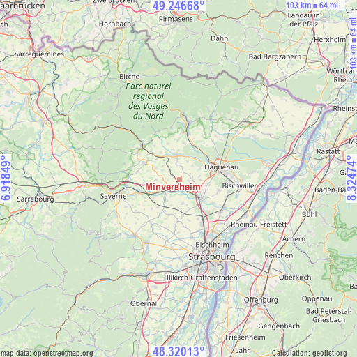
Minversheim GPS coordinates[2]
48° 47' 7.944" North, 7° 37' 17.796" East
| Map corner | latitude | longitude |
|---|---|---|
| Upper-left | 49.24668°, | 6.91849° |
| Center: | 48.78554°, | 7.62161° |
| Lower-right: | 48.32013°, | 8.32474° |
| Map W x H: | 103×103 km | = 64×64mi |
| max Lat: | 51.07786° ⇑24.8% North |
| Minversheim: | 48.78554° |
| min Lat: | ⇓75.2% South 41.3874° |
| min Long | Minversheim | max Long |
| -5.08615° | 7.62161° | 9.52242° |
| W 98.7%⇐ | ⇒1.3% E |
Elevation
Elevation of Minversheim is 205 m = 673 ft, and this is 11.3 m = 37 ft above average elevation for this country.
| Max E: |
2333 m = 7654 ft | 32.8% |
| Minversheim | 205 m 673 ft | |
| Avg. | 193.7 m = 635 ft | |
Min E: |
-1 m = -3 ft | 67.2% |
See also: France elevation on elevation.city.
Geographical zone
Minversheim is located in North temperate zone (between Tropic of Cancer and the Arctic Circle). Distance of this North polar circle is 1976.7 km =1228.3 mi to North.| Distance of | km | miles | from Minversheim |
|---|---|---|---|
| North Pole | 4582.6 | 2847.5 | to North |
| Arctic Circle | 1976.7 | 1228.3 | to North |
| Tropic Cancer | 2818.5 | 1751.3 | to South |
| Equator | 5424.4 | 3370.6 | to South |


Nearby cities:
15 places around Minversheim: (largest is in red/bold)
• Alteckendorf
1.9 km =1.2 mi,  290°
290°
• Batzendorf
6.2 km =3.9 mi,  92°
92°
• Bernolsheim
6 km =3.7 mi,  123°
123°
• Dauendorf
5.5 km =3.4 mi,  26°
26°
• Ettendorf
4.2 km =2.6 mi,  316°
316°
• Hochfelden
5 km =3.1 mi,  231°
231°
• Mommenheim
3.5 km =2.2 mi,  150°
150°
• Niedermodern
6.6 km =4.1 mi,  3°
3°
• Ohlungen
6.7 km =4.2 mi,  62°
62°
• Pfaffenhoffen
6.4 km =4 mi,  350°
350°
• Schwindratzheim
3.7 km =2.3 mi,  206°
206°
• Uhlwiller
5.5 km =3.4 mi,  44°
44°
• Waltenheim-sur-Zorn
4.3 km =2.7 mi,  172°
172°
• Wintershouse
5.8 km =3.6 mi,  82°
82°
• Wittersheim
2.7 km =1.7 mi,  98°
98°
Sources, notices
• [Note1] Compared only with cities in France existing in our database
• [Src1] Map data: © OpenStreetMap contributors (CC-BY-SA)
• [Src2] Other city data from geonames.org with taken over terms of usage.
• [Src3] Geographical zone / Annual Mean Temperature by Robert A. Rohde @ Wikipedia
