Uhlwiller geodata
Uhlwiller (Grand Est) is a populated place; located in France in Europe/Paris (GMT+2) time zone. With population of 663 people, there are 12328 cities with bigger population in this country. Compared to other cities in France, 76% of cities are located further ↓South; 98.9% of cities are located further ←West and 66.2% of cities have lower elevation than Uhlwiller. Note1
Administrative division(s):
- Level 1: Grand Est
- Level 2: Bas-Rhin
- Level 3: Arrondissement de Haguenau-Wissembourg
- Level 4: Uhlwiller


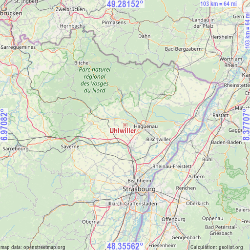
Uhlwiller GPS coordinates[2]
48° 49' 14.556" North, 7° 40' 26.22" East
| Map corner | latitude | longitude |
|---|---|---|
| Upper-left | 49.28152°, | 6.97082° |
| Center: | 48.82071°, | 7.67395° |
| Lower-right: | 48.35562°, | 8.37707° |
| Map W x H: | 103×102.9 km | = 64×63.9mi |
| max Lat: | 51.07786° ⇑24% North |
| Uhlwiller: | 48.82071° |
| min Lat: | ⇓76% South 41.3874° |
| min Long | Uhlwiller | max Long |
| -5.08615° | 7.67395° | 9.52242° |
| W 98.9%⇐ | ⇒1.1% E |
Elevation
Elevation of Uhlwiller is 200 m = 656 ft, and this is 6.3 m = 21 ft above average elevation for this country.
| Max E: |
2333 m = 7654 ft | 33.8% |
| Uhlwiller | 200 m 656 ft | |
| Avg. | 193.7 m = 635 ft | |
Min E: |
-1 m = -3 ft | 66.2% |
See also: France elevation on elevation.city.
Geographical zone
Uhlwiller is located in North temperate zone (between Tropic of Cancer and the Arctic Circle). Distance of this North polar circle is 1972.8 km =1225.8 mi to North.| Distance of | km | miles | from Uhlwiller |
|---|---|---|---|
| North Pole | 4578.7 | 2845.1 | to North |
| Arctic Circle | 1972.8 | 1225.8 | to North |
| Tropic Cancer | 2822.4 | 1753.8 | to South |
| Equator | 5428.4 | 3373.1 | to South |


Nearby cities:
15 places around Uhlwiller: (largest is in red/bold)
• Alteckendorf
6.5 km =4 mi,  240°
240°
• Batzendorf
4.8 km =3 mi,  150°
150°
• Dauendorf
1.7 km =1.1 mi,  306°
306°
• Ettendorf
6.8 km =4.2 mi,  262°
262°
• Mertzwiller
5 km =3.1 mi,  6°
6°
• Mietesheim
6.9 km =4.3 mi,  339°
339°
• Minversheim
5.5 km =3.4 mi,  224°
224°
• Niedermodern
4.4 km =2.7 mi, 308°
• Niederschaeffolsheim
7.2 km =4.5 mi,  138°
138°
• Ohlungen
2.2 km =1.4 mi,  111°
111°
• Pfaffenhoffen
5.4 km =3.4 mi,  296°
296°
• Schweighouse-sur-Moder
4 km =2.5 mi,  90°
90°
• Uberach
4.6 km =2.9 mi, 314°
• Wintershouse
3.7 km =2.3 mi, 148°
• Wittersheim
4.5 km =2.8 mi,  194°
194°
Sources, notices
• [Note1] Compared only with cities in France existing in our database
• [Src1] Map data: © OpenStreetMap contributors (CC-BY-SA)
• [Src2] Other city data from geonames.org with taken over terms of usage.
• [Src3] Geographical zone / Annual Mean Temperature by Robert A. Rohde @ Wikipedia
