Batzendorf geodata
Batzendorf (Grand Est) is a populated place; located in France in Europe/Paris (GMT+2) time zone. With population of 922 people, there are 9460 cities with bigger population in this country. Compared to other cities in France, 75.1% of cities are located further ↓South; 99% of cities are located further ←West and 65.6% of cities have lower elevation than Batzendorf. Note1
Administrative division(s):
- Level 1: Grand Est
- Level 2: Bas-Rhin
- Level 3: Arrondissement de Haguenau-Wissembourg
- Level 4: Batzendorf


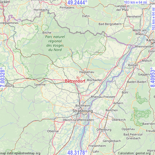
Batzendorf GPS coordinates[2]
48° 46' 59.664" North, 7° 42' 23.04" East
| Map corner | latitude | longitude |
|---|---|---|
| Upper-left | 49.2444°, | 7.00328° |
| Center: | 48.78324°, | 7.7064° |
| Lower-right: | 48.3178°, | 8.40953° |
| Map W x H: | 103×103 km | = 64×64mi |
| max Lat: | 51.07786° ⇑24.9% North |
| Batzendorf: | 48.78324° |
| min Lat: | ⇓75.1% South 41.3874° |
| min Long | Batzendorf | max Long |
| -5.08615° | 7.7064° | 9.52242° |
| W 99%⇐ | ⇒1% E |
Elevation
Elevation of Batzendorf is 197 m = 646 ft, and this is 3.3 m = 11 ft above average elevation for this country.
| Max E: |
2333 m = 7654 ft | 34.4% |
| Batzendorf | 197 m 646 ft | |
| Avg. | 193.7 m = 635 ft | |
Min E: |
-1 m = -3 ft | 65.6% |
See also: France elevation on elevation.city.
Geographical zone
Batzendorf is located in North temperate zone (between Tropic of Cancer and the Arctic Circle). Distance of this North polar circle is 1977 km =1228.5 mi to North.| Distance of | km | miles | from Batzendorf |
|---|---|---|---|
| North Pole | 4582.9 | 2847.7 | to North |
| Arctic Circle | 1977 | 1228.5 | to North |
| Tropic Cancer | 2818.3 | 1751.2 | to South |
| Equator | 5424.2 | 3370.4 | to South |


Nearby cities:
15 places around Batzendorf: (largest is in red/bold)
• Bernolsheim
3.3 km =2.1 mi,  202°
202°
• Brumath
5.5 km =3.4 mi,  176°
176°
• Dauendorf
6.4 km =4 mi,  324°
324°
• Haguenau
7.1 km =4.4 mi,  59°
59°
• Kriegsheim
3.2 km =2 mi,  150°
150°
• Minversheim
6.2 km =3.9 mi,  272°
272°
• Mommenheim
5.3 km =3.3 mi,  237°
237°
• Niederschaeffolsheim
2.7 km =1.7 mi,  117°
117°
• Ohlungen
3.4 km =2.1 mi,  354°
354°
• Schweighouse-sur-Moder
4.4 km =2.7 mi,  21°
21°
• Uhlwiller
4.8 km =3 mi,  330°
330°
• Waltenheim-sur-Zorn
6.9 km =4.3 mi,  234°
234°
• Weitbruch
6.2 km =3.9 mi, 120°
• Wintershouse
1.1 km =0.7 mi,  337°
337°
• Wittersheim
3.5 km =2.2 mi, 267°
Sources, notices
• [Note1] Compared only with cities in France existing in our database
• [Src1] Map data: © OpenStreetMap contributors (CC-BY-SA)
• [Src2] Other city data from geonames.org with taken over terms of usage.
• [Src3] Geographical zone / Annual Mean Temperature by Robert A. Rohde @ Wikipedia
