Mézin geodata
Mézin (Nouvelle-Aquitaine) is a populated place; located in France in Europe/Paris (GMT+2) time zone. With population of 1,519 people, there are 6125 cities with bigger population in this country. Compared to other cities in France, 86.6% of cities are located further ↑North; 75.7% of cities are located further →East and 54.4% of cities have higher elevation than Mézin. Note1
Administrative division(s):
- Level 1: Nouvelle-Aquitaine
- Level 2: Département du Lot-et-Garonne
- Level 3: Arrondissement de Nérac
- Level 4: Mézin


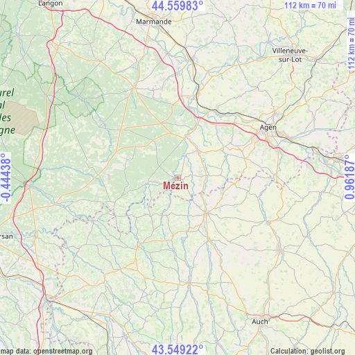
Mézin GPS coordinates[2]
44° 3' 24.048" North, 0° 15' 31.464" East
| Map corner | latitude | longitude |
|---|---|---|
| Upper-left | 44.55983°, | -0.44438° |
| Center: | 44.05668°, | 0.25874° |
| Lower-right: | 43.54922°, | 0.96187° |
| Map W x H: | 112.4×112.4 km | = 69.8×69.8mi |
| max Lat: | 51.07786° ⇑86.6% North |
| Mézin: | 44.05668° |
| min Lat: | ⇓13.4% South 41.3874° |
| min Long | Mézin | max Long |
| -5.08615° | 0.25874° | 9.52242° |
| W 24.3%⇐ | ⇒75.7% E |
Elevation
Elevation of Mézin is 118 m = 387 ft, and this is 75.7 m = 248 ft below average elevation for this country.
| Max E: |
2333 m = 7654 ft | 54.4% |
| Avg. | 193.7 m = 635 ft | |
| Mézin | 118 m = 387 ft | |
Min E: |
-1 m = -3 ft | 45.6% |
See also: France elevation on elevation.city.
Geographical zone
Mézin is located in North temperate zone (between Tropic of Cancer and the Arctic Circle). Distance of this Northern Tropic circle is 2292.7 km =1424.6 mi to South.| Distance of | km | miles | from Mézin |
|---|---|---|---|
| North Pole | 5108.4 | 3174.2 | to North |
| Arctic Circle | 2502.5 | 1555 | to North |
| Tropic Cancer | 2292.7 | 1424.6 | to South |
| Equator | 4898.6 | 3043.8 | to South |


Nearby cities:
15 places around Mézin: (largest is in red/bold)
• Barbaste
12.7 km =7.9 mi,  10°
10°
• Bruch
20.5 km =12.7 mi,  36°
36°
• Caussens
18.3 km =11.4 mi,  133°
133°
• Condom
14.2 km =8.8 mi,  140°
140°
• Feugarolles
19.7 km =12.2 mi,  21°
21°
• Francescas
13.6 km =8.5 mi,  86°
86°
• Gondrin
19.2 km =11.9 mi,  185°
185°
• Lavardac
13.8 km =8.6 mi, 13°
• Lisse
5.9 km =3.7 mi,  339°
339°
• Moncrabeau
9.3 km =5.8 mi,  105°
105°
• Montagnac-sur-Auvignon
19.8 km =12.3 mi,  54°
54°
• Montréal
12.6 km =7.8 mi,  200°
200°
• Nérac
10.9 km =6.8 mi, 36°
• Sos
9.5 km =5.9 mi,  260°
260°
• Vianne
16.3 km =10.1 mi, 17°
Sources, notices
• [Note1] Compared only with cities in France existing in our database
• [Src1] Map data: © OpenStreetMap contributors (CC-BY-SA)
• [Src2] Other city data from geonames.org with taken over terms of usage.
• [Src3] Geographical zone / Annual Mean Temperature by Robert A. Rohde @ Wikipedia
