Gondrin geodata
Gondrin (Occitanie) is a populated place; located in France in Europe/Paris (GMT+2) time zone. With population of 1,049 people, there are 8470 cities with bigger population in this country. Compared to other cities in France, 88.2% of cities are located further ↑North; 75.9% of cities are located further →East and 62.5% of cities have lower elevation than Gondrin. Note1
Administrative division(s):
- Level 1: Occitanie
- Level 2: Gers
- Level 3: Arrondissement de Condom
- Level 4: Gondrin


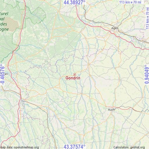
Gondrin GPS coordinates[2]
43° 53' 4.776" North, 0° 14' 14.532" East
| Map corner | latitude | longitude |
|---|---|---|
| Upper-left | 44.38927°, | -0.46576° |
| Center: | 43.88466°, | 0.23737° |
| Lower-right: | 43.37574°, | 0.94049° |
| Map W x H: | 112.7×112.7 km | = 70×70mi |
| max Lat: | 51.07786° ⇑88.2% North |
| Gondrin: | 43.88466° |
| min Lat: | ⇓11.8% South 41.3874° |
| min Long | Gondrin | max Long |
| -5.08615° | 0.23737° | 9.52242° |
| W 24.1%⇐ | ⇒75.9% E |
Elevation
Elevation of Gondrin is 182 m = 597 ft, and this is 11.7 m = 38 ft below average elevation for this country.
| Max E: |
2333 m = 7654 ft | 37.5% |
| Avg. | 193.7 m = 635 ft | |
| Gondrin | 182 m = 597 ft | |
Min E: |
-1 m = -3 ft | 62.5% |
See also: France elevation on elevation.city.
Geographical zone
Gondrin is located in North temperate zone (between Tropic of Cancer and the Arctic Circle). Distance of this Northern Tropic circle is 2273.6 km =1412.7 mi to South.| Distance of | km | miles | from Gondrin |
|---|---|---|---|
| North Pole | 5127.5 | 3186.1 | to North |
| Arctic Circle | 2521.7 | 1566.9 | to North |
| Tropic Cancer | 2273.6 | 1412.7 | to South |
| Equator | 4879.5 | 3032 | to South |


Nearby cities:
15 places around Gondrin: (largest is in red/bold)
• Castéra-Verduzan
17.8 km =11.1 mi,  119°
119°
• Caussens
16.3 km =10.1 mi,  66°
66°
• Condom
13.5 km =8.4 mi,  52°
52°
• Eauze
11.2 km =7 mi,  256°
256°
• Gabarret
21.5 km =13.4 mi,  302°
302°
• Lannepax
9.4 km =5.8 mi,  184°
184°
• Manciet
18.2 km =11.3 mi,  238°
238°
• Moncrabeau
19.8 km =12.3 mi,  32°
32°
• Montréal
7.8 km =4.8 mi,  339°
339°
• Mézin
19.2 km =11.9 mi,  5°
5°
• Parleboscq
19.8 km =12.3 mi,  285°
285°
• Saint-Puy
18.1 km =11.2 mi,  92°
92°
• Sos
19.1 km =11.9 mi, 336°
• Valence-sur-Baïse
11.5 km =7.1 mi, 91°
• Vic-Fezensac
14 km =8.7 mi,  153°
153°
Sources, notices
• [Note1] Compared only with cities in France existing in our database
• [Src1] Map data: © OpenStreetMap contributors (CC-BY-SA)
• [Src2] Other city data from geonames.org with taken over terms of usage.
• [Src3] Geographical zone / Annual Mean Temperature by Robert A. Rohde @ Wikipedia
