Caussens geodata
Caussens (Occitanie) is a populated place; located in France in Europe/Paris (GMT+2) time zone. With population of 584 people, there are 13570 cities with bigger population in this country. Compared to other cities in France, 87.6% of cities are located further ↑North; 74.1% of cities are located further →East and 67.4% of cities have lower elevation than Caussens. Note1
Administrative division(s):
- Level 1: Occitanie
- Level 2: Gers
- Level 3: Arrondissement de Condom
- Level 4: Caussens


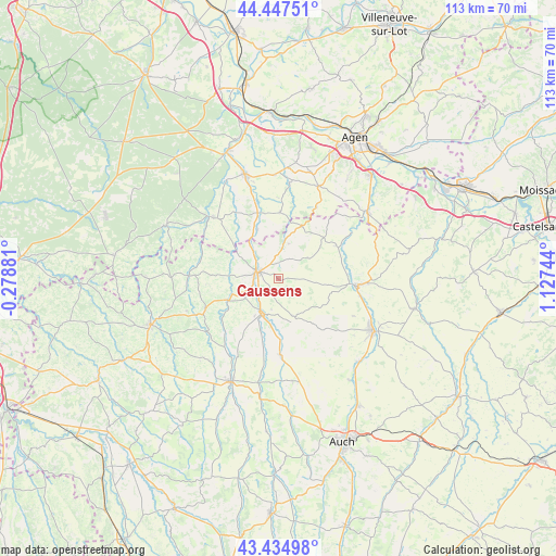
Caussens GPS coordinates[2]
43° 56' 36.24" North, 0° 25' 27.552" East
| Map corner | latitude | longitude |
|---|---|---|
| Upper-left | 44.44751°, | -0.27881° |
| Center: | 43.9434°, | 0.42432° |
| Lower-right: | 43.43498°, | 1.12744° |
| Map W x H: | 112.6×112.6 km | = 70×70mi |
| max Lat: | 51.07786° ⇑87.6% North |
| Caussens: | 43.9434° |
| min Lat: | ⇓12.4% South 41.3874° |
| min Long | Caussens | max Long |
| -5.08615° | 0.42432° | 9.52242° |
| W 25.9%⇐ | ⇒74.1% E |
Elevation
Elevation of Caussens is 206 m = 676 ft, and this is 12.3 m = 40 ft above average elevation for this country.
| Max E: |
2333 m = 7654 ft | 32.6% |
| Caussens | 206 m 676 ft | |
| Avg. | 193.7 m = 635 ft | |
Min E: |
-1 m = -3 ft | 67.4% |
See also: France elevation on elevation.city.
Geographical zone
Caussens is located in North temperate zone (between Tropic of Cancer and the Arctic Circle). Distance of this Northern Tropic circle is 2280.1 km =1416.8 mi to South.| Distance of | km | miles | from Caussens |
|---|---|---|---|
| North Pole | 5121 | 3182 | to North |
| Arctic Circle | 2515.1 | 1562.8 | to North |
| Tropic Cancer | 2280.1 | 1416.8 | to South |
| Equator | 4886 | 3036 | to South |


Nearby cities:
15 places around Caussens: (largest is in red/bold)
• Castéra-Verduzan
15.3 km =9.5 mi,  178°
178°
• Condom
4.5 km =2.8 mi,  291°
291°
• Francescas
13.4 km =8.3 mi,  1°
1°
• Gondrin
16.3 km =10.1 mi,  246°
246°
• Jegun
19.9 km =12.4 mi,  170°
170°
• La Romieu
7.4 km =4.6 mi,  54°
54°
• Laplume
20.6 km =12.8 mi,  24°
24°
• Lectoure
15.8 km =9.8 mi,  93°
93°
• Moncrabeau
10.9 km =6.8 mi,  337°
337°
• Montréal
17.7 km =11 mi,  272°
272°
• Mézin
18.3 km =11.4 mi,  313°
313°
• Pauilhac
16.8 km =10.4 mi,  116°
116°
• Saint-Puy
8 km =5 mi,  156°
156°
• Valence-sur-Baïse
7.6 km =4.7 mi,  207°
207°
• Vic-Fezensac
21 km =13 mi,  204°
204°
Sources, notices
• [Note1] Compared only with cities in France existing in our database
• [Src1] Map data: © OpenStreetMap contributors (CC-BY-SA)
• [Src2] Other city data from geonames.org with taken over terms of usage.
• [Src3] Geographical zone / Annual Mean Temperature by Robert A. Rohde @ Wikipedia
