La Roche-Blanche geodata
La Roche-Blanche (Pays de la Loire) is a populated place; located in France in Europe/Paris (GMT+2) time zone. With population of 929 people, there are 9398 cities with bigger population in this country. Compared to other cities in France, 50.4% of cities are located further ↓South; 89.5% of cities are located further →East and 71.9% of cities have higher elevation than La Roche-Blanche. Note1
Administrative division(s):
- Level 1: Pays de la Loire
- Level 2: Loire-Atlantique
- Level 3: Arrondissement of Châteaubriant-Ancenis
- Level 4: La Roche-Blanche


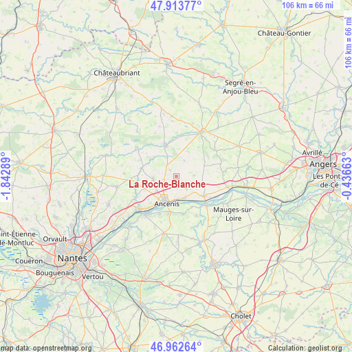
La Roche-Blanche GPS coordinates[2]
47° 26' 25.26" North, 1° 8' 23.136" West
| Map corner | latitude | longitude |
|---|---|---|
| Upper-left | 47.91377°, | -1.84289° |
| Center: | 47.44035°, | -1.13976° |
| Lower-right: | 46.96264°, | -0.43663° |
| Map W x H: | 105.8×105.8 km | = 65.7×65.7mi |
| max Lat: | 51.07786° ⇑49.6% North |
| La Roche-Blanche: | 47.44035° |
| min Lat: | ⇓50.4% South 41.3874° |
| min Long | La Roche-Blanch | max Long |
| -5.08615° | -1.13976° | 9.52242° |
| W 10.5%⇐ | ⇒89.5% E |
Elevation
Elevation of La Roche-Blanche is 74 m = 243 ft, and this is 119.7 m = 393 ft below average elevation for this country.
| Max E: |
2333 m = 7654 ft | 71.9% |
| Avg. | 193.7 m = 635 ft | |
| La Roche-Blanche | 74 m = 243 ft | |
Min E: |
-1 m = -3 ft | 28.1% |
See also: France elevation on elevation.city.
Geographical zone
La Roche-Blanche is located in North temperate zone (between Tropic of Cancer and the Arctic Circle). Distance of this North polar circle is 2126.3 km =1321.2 mi to North.| Distance of | km | miles | from La Roche-Blanche |
|---|---|---|---|
| North Pole | 4732.2 | 2940.5 | to North |
| Arctic Circle | 2126.3 | 1321.2 | to North |
| Tropic Cancer | 2669 | 1658.4 | to South |
| Equator | 5274.9 | 3277.7 | to South |


Nearby cities:
15 places around La Roche-Blanche: (largest is in red/bold)
• Ancenis
8.4 km =5.2 mi,  193°
193°
• Anetz
7.1 km =4.4 mi,  158°
158°
• Belligné
9 km =5.6 mi,  70°
70°
• La Rouxière
5.5 km =3.4 mi,  87°
87°
• Le Marillais
10.4 km =6.5 mi,  152°
152°
• Liré
11 km =6.8 mi, 190°
• Maumusson
5.3 km =3.3 mi,  28°
28°
• Mésanger
6.7 km =4.2 mi,  261°
261°
• Pannecé
9 km =5.6 mi,  304°
304°
• Pouillé-les-Côteaux
2.4 km =1.5 mi,  315°
315°
• Saint-Géréon
9.4 km =5.8 mi,  210°
210°
• Saint-Herblon
4.8 km =3 mi,  138°
138°
• Saint-Mars-la-Jaille
10.1 km =6.3 mi,  340°
340°
• Teillé
10.7 km =6.6 mi,  282°
282°
• Varades
10.4 km =6.5 mi,  126°
126°
Sources, notices
• [Note1] Compared only with cities in France existing in our database
• [Src1] Map data: © OpenStreetMap contributors (CC-BY-SA)
• [Src2] Other city data from geonames.org with taken over terms of usage.
• [Src3] Geographical zone / Annual Mean Temperature by Robert A. Rohde @ Wikipedia
