Méru geodata
Méru (Hauts-de-France) is a populated place; located in France in Europe/Paris (GMT+2) time zone. With population of 13,528 people, there are 704 cities with bigger population in this country. Compared to other cities in France, 84.9% of cities are located further ↓South; 55.4% of cities are located further →East and 61.2% of cities have higher elevation than Méru. Note1
Administrative division(s):
- Level 1: Hauts-de-France
- Level 2: Département de l'Oise
- Level 3: Arrondissement de Beauvais
- Level 4: Méru


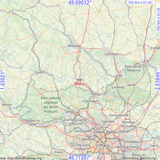
Méru GPS coordinates[2]
49° 13' 59.988" North, 2° 7' 59.988" East
| Map corner | latitude | longitude |
|---|---|---|
| Upper-left | 49.69032°, | 1.43021° |
| Center: | 49.23333°, | 2.13333° |
| Lower-right: | 48.77207°, | 2.83646° |
| Map W x H: | 102.1×102.1 km | = 63.4×63.4mi |
| max Lat: | 51.07786° ⇑15.1% North |
| Méru: | 49.23333° |
| min Lat: | ⇓84.9% South 41.3874° |
| min Long | Méru | max Long |
| -5.08615° | 2.13333° | 9.52242° |
| W 44.6%⇐ | ⇒55.4% E |
Elevation
Elevation of Méru is 99 m = 325 ft, and this is 94.7 m = 311 ft below average elevation for this country.
| Max E: |
2333 m = 7654 ft | 61.2% |
| Avg. | 193.7 m = 635 ft | |
| Méru | 99 m = 325 ft | |
Min E: |
-1 m = -3 ft | 38.8% |
See also: France elevation on elevation.city.
Geographical zone
Méru is located in North temperate zone (between Tropic of Cancer and the Arctic Circle). Distance of this North polar circle is 1926.9 km =1197.3 mi to North.| Distance of | km | miles | from Méru |
|---|---|---|---|
| North Pole | 4532.8 | 2816.6 | to North |
| Arctic Circle | 1926.9 | 1197.3 | to North |
| Tropic Cancer | 2868.3 | 1782.3 | to South |
| Equator | 5474.2 | 3401.5 | to South |


Nearby cities:
15 places around Méru: (largest is in red/bold)
• Amblainville
3.3 km =2.1 mi,  193°
193°
• Andeville
3.8 km =2.4 mi,  36°
36°
• Arronville
6.1 km =3.8 mi, 193°
• Belle-Église
7.7 km =4.8 mi,  126°
126°
• Bornel
6.7 km =4.2 mi, 125°
• Esches
2.7 km =1.7 mi,  120°
120°
• Fosseuse
4.5 km =2.8 mi, 120°
• Hénonville
6.5 km =4 mi,  243°
243°
• Ivry-le-Temple
7.5 km =4.7 mi,  266°
266°
• Laboissière-en-Thelle
7 km =4.3 mi,  17°
17°
• Lormaison
3.3 km =2.1 mi,  322°
322°
• Mortefontaine-en-Thelle
5.2 km =3.2 mi,  49°
49°
• Puiseux-le-Hauberger
7.7 km =4.8 mi,  103°
103°
• Saint-Crépin-Ibouvillers
5.2 km =3.2 mi,  309°
309°
• Villeneuve-les-Sablons
4.1 km =2.5 mi,  276°
276°
Sources, notices
• [Note1] Compared only with cities in France existing in our database
• [Src1] Map data: © OpenStreetMap contributors (CC-BY-SA)
• [Src2] Other city data from geonames.org with taken over terms of usage.
• [Src3] Geographical zone / Annual Mean Temperature by Robert A. Rohde @ Wikipedia
