Mortefontaine-en-Thelle geodata
Mortefontaine-en-Thelle (Hauts-de-France) is a populated place; located in France in Europe/Paris (GMT+2) time zone. With population of 763 people, there are 11026 cities with bigger population in this country. Compared to other cities in France, 85.4% of cities are located further ↓South; 54.6% of cities are located further →East and 56.2% of cities have higher elevation than Mortefontaine-en-Thelle. Note1
Administrative division(s):
- Level 1: Hauts-de-France
- Level 2: Département de l'Oise
- Level 3: Arrondissement de Beauvais
- Level 4: Mortefontaine-en-Thelle
Current local time in Mortefontaine-en-Thelle:
07:57 AM, SaturdayDifference from your time zone: hours


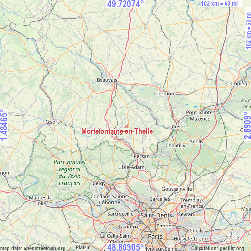
Mortefontaine-en-Thelle GPS coordinates[2]
49° 15' 50.508" North, 2° 11' 15.972" East
| Map corner | latitude | longitude |
|---|---|---|
| Upper-left | 49.72074°, | 1.48465° |
| Center: | 49.26403°, | 2.18777° |
| Lower-right: | 48.80305°, | 2.8909° |
| Map W x H: | 102×102 km | = 63.4×63.4mi |
| max Lat: | 51.07786° ⇑14.6% North |
| Mortefontaine-en-Thelle: | 49.26403° |
| min Lat: | ⇓85.4% South 41.3874° |
| min Long | Mortefontaine-e | max Long |
| -5.08615° | 2.18777° | 9.52242° |
| W 45.4%⇐ | ⇒54.6% E |
Elevation
Elevation of Mortefontaine-en-Thelle is 113 m = 371 ft, and this is 80.7 m = 265 ft below average elevation for this country.
| Max E: |
2333 m = 7654 ft | 56.2% |
| Avg. | 193.7 m = 635 ft | |
| Mortefontaine-en-Thelle | 113 m = 371 ft | |
Min E: |
-1 m = -3 ft | 43.8% |
See also: France elevation on elevation.city.
Geographical zone
Mortefontaine-en-Thelle is located in North temperate zone (between Tropic of Cancer and the Arctic Circle). Distance of this North polar circle is 1923.5 km =1195.2 mi to North.| Distance of | km | miles | from Mortefontaine-en-Thelle |
|---|---|---|---|
| North Pole | 4529.4 | 2814.4 | to North |
| Arctic Circle | 1923.5 | 1195.2 | to North |
| Tropic Cancer | 2871.7 | 1784.4 | to South |
| Equator | 5477.6 | 3403.6 | to South |


Nearby cities:
15 places around Mortefontaine-en-Thelle: (largest is in red/bold)
• Andeville
1.7 km =1.1 mi,  258°
258°
• Bornel
7.5 km =4.7 mi,  168°
168°
• Cauvigny
6.1 km =3.8 mi,  46°
46°
• Esches
5.1 km =3.2 mi,  198°
198°
• Fosseuse
5.7 km =3.5 mi,  180°
180°
• Laboissière-en-Thelle
3.8 km =2.4 mi,  329°
329°
• Lachapelle-Saint-Pierre
3.5 km =2.2 mi,  80°
80°
• Le Coudray-sur-Thelle
6.5 km =4 mi,  315°
315°
• Lormaison
6 km =3.7 mi, 261°
• Méru
5.2 km =3.2 mi,  229°
229°
• Noailles
7.2 km =4.5 mi,  7°
7°
• Puiseux-le-Hauberger
6.3 km =3.9 mi,  145°
145°
• Saint-Crépin-Ibouvillers
8 km =5 mi,  269°
269°
• Sainte-Geneviève
2.9 km =1.8 mi,  16°
16°
• Ully-Saint-Georges
7 km =4.3 mi, 76°
Sources, notices
• [Note1] Compared only with cities in France existing in our database
• [Src1] Map data: © OpenStreetMap contributors (CC-BY-SA)
• [Src2] Other city data from geonames.org with taken over terms of usage.
• [Src3] Geographical zone / Annual Mean Temperature by Robert A. Rohde @ Wikipedia
