Andeville geodata
Andeville (Hauts-de-France) is a populated place; located in France in Europe/Paris (GMT+2) time zone. With population of 3,113 people, there are 3135 cities with bigger population in this country. Compared to other cities in France, 85.4% of cities are located further ↓South; 55% of cities are located further →East and 57.1% of cities have lower elevation than Andeville. Note1
Administrative division(s):
- Level 1: Hauts-de-France
- Level 2: Département de l'Oise
- Level 3: Arrondissement de Beauvais
- Level 4: Andeville


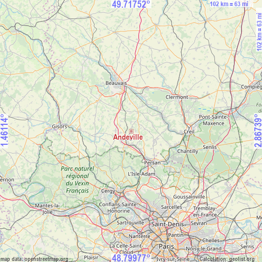
Andeville GPS coordinates[2]
49° 15' 38.808" North, 2° 9' 51.372" East
| Map corner | latitude | longitude |
|---|---|---|
| Upper-left | 49.71752°, | 1.46114° |
| Center: | 49.26078°, | 2.16427° |
| Lower-right: | 48.79977°, | 2.86739° |
| Map W x H: | 102×102 km | = 63.4×63.4mi |
| max Lat: | 51.07786° ⇑14.6% North |
| Andeville: | 49.26078° |
| min Lat: | ⇓85.4% South 41.3874° |
| min Long | Andeville | max Long |
| -5.08615° | 2.16427° | 9.52242° |
| W 45%⇐ | ⇒55% E |
Elevation
Elevation of Andeville is 158 m = 518 ft, and this is 35.7 m = 117 ft below average elevation for this country.
| Max E: |
2333 m = 7654 ft | 42.9% |
| Avg. | 193.7 m = 635 ft | |
| Andeville | 158 m = 518 ft | |
Min E: |
-1 m = -3 ft | 57.1% |
See also: France elevation on elevation.city.
Geographical zone
Andeville is located in North temperate zone (between Tropic of Cancer and the Arctic Circle). Distance of this North polar circle is 1923.9 km =1195.5 mi to North.| Distance of | km | miles | from Andeville |
|---|---|---|---|
| North Pole | 4529.8 | 2814.7 | to North |
| Arctic Circle | 1923.9 | 1195.5 | to North |
| Tropic Cancer | 2871.4 | 1784.2 | to South |
| Equator | 5477.3 | 3403.4 | to South |


Nearby cities:
15 places around Andeville: (largest is in red/bold)
• Amblainville
7 km =4.3 mi,  205°
205°
• Bornel
7.7 km =4.8 mi,  154°
154°
• Cauvigny
7.6 km =4.7 mi,  53°
53°
• Esches
4.4 km =2.7 mi,  178°
178°
• Fosseuse
5.6 km =3.5 mi,  162°
162°
• Laboissière-en-Thelle
3.6 km =2.2 mi,  356°
356°
• Lachapelle-Saint-Pierre
5.2 km =3.2 mi,  79°
79°
• Le Coudray-sur-Thelle
5.8 km =3.6 mi,  329°
329°
• Lormaison
4.3 km =2.7 mi,  263°
263°
• Mortefontaine-en-Thelle
1.7 km =1.1 mi, 78°
• Méru
3.8 km =2.4 mi,  216°
216°
• Puiseux-le-Hauberger
7.2 km =4.5 mi,  132°
132°
• Saint-Crépin-Ibouvillers
6.3 km =3.9 mi,  272°
272°
• Sainte-Geneviève
4 km =2.5 mi,  38°
38°
• Villeneuve-les-Sablons
6.8 km =4.2 mi,  247°
247°
Sources, notices
• [Note1] Compared only with cities in France existing in our database
• [Src1] Map data: © OpenStreetMap contributors (CC-BY-SA)
• [Src2] Other city data from geonames.org with taken over terms of usage.
• [Src3] Geographical zone / Annual Mean Temperature by Robert A. Rohde @ Wikipedia
