Fosseuse geodata
Fosseuse (Hauts-de-France) is a populated place; located in France in Europe/Paris (GMT+2) time zone. With population of 770 people, there are 10937 cities with bigger population in this country. Compared to other cities in France, 84.5% of cities are located further ↓South; 54.7% of cities are located further →East and 77.8% of cities have higher elevation than Fosseuse. Note1
Administrative division(s):
- Level 1: Hauts-de-France
- Level 2: Département de l'Oise
- Level 3: Arrondissement de Beauvais
- Level 4: Bornel


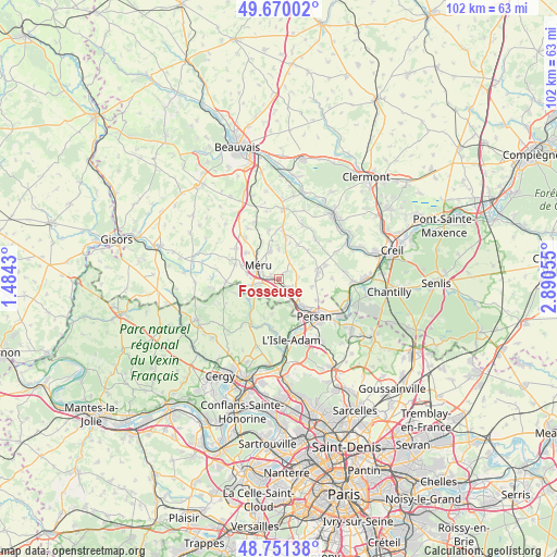
Fosseuse GPS coordinates[2]
49° 12' 46.188" North, 2° 11' 14.712" East
| Map corner | latitude | longitude |
|---|---|---|
| Upper-left | 49.67002°, | 1.4843° |
| Center: | 49.21283°, | 2.18742° |
| Lower-right: | 48.75138°, | 2.89055° |
| Map W x H: | 102.1×102.1 km | = 63.4×63.4mi |
| max Lat: | 51.07786° ⇑15.5% North |
| Fosseuse: | 49.21283° |
| min Lat: | ⇓84.5% South 41.3874° |
| min Long | Fosseuse | max Long |
| -5.08615° | 2.18742° | 9.52242° |
| W 45.3%⇐ | ⇒54.7% E |
Elevation
Elevation of Fosseuse is 60 m = 197 ft, and this is 133.7 m = 439 ft below average elevation for this country.
| Max E: |
2333 m = 7654 ft | 77.8% |
| Avg. | 193.7 m = 635 ft | |
| Fosseuse | 60 m = 197 ft | |
Min E: |
-1 m = -3 ft | 22.2% |
See also: France elevation on elevation.city.
Geographical zone
Fosseuse is located in North temperate zone (between Tropic of Cancer and the Arctic Circle). Distance of this North polar circle is 1929.2 km =1198.7 mi to North.| Distance of | km | miles | from Fosseuse |
|---|---|---|---|
| North Pole | 4535.1 | 2818 | to North |
| Arctic Circle | 1929.2 | 1198.7 | to North |
| Tropic Cancer | 2866 | 1780.8 | to South |
| Equator | 5472 | 3400.1 | to South |


Nearby cities:
15 places around Fosseuse: (largest is in red/bold)
• Amblainville
4.8 km =3 mi,  258°
258°
• Andeville
5.6 km =3.5 mi,  342°
342°
• Arronville
6.5 km =4 mi,  235°
235°
• Belle-Église
3.2 km =2 mi,  134°
134°
• Bornel
2.3 km =1.4 mi,  135°
135°
• Chambly
6.9 km =4.3 mi, 138°
• Esches
1.8 km =1.1 mi,  299°
299°
• Fresnoy-en-Thelle
6.1 km =3.8 mi,  103°
103°
• Lachapelle-Saint-Pierre
7.2 km =4.5 mi,  28°
28°
• Lormaison
7.7 km =4.8 mi,  309°
309°
• Mortefontaine-en-Thelle
5.7 km =3.5 mi,  0°
0°
• Méru
4.5 km =2.8 mi, 300°
• Neuilly-en-Thelle
7.2 km =4.5 mi,  79°
79°
• Puiseux-le-Hauberger
3.6 km =2.2 mi, 82°
• Ronquerolles
5.8 km =3.6 mi,  152°
152°
Sources, notices
• [Note1] Compared only with cities in France existing in our database
• [Src1] Map data: © OpenStreetMap contributors (CC-BY-SA)
• [Src2] Other city data from geonames.org with taken over terms of usage.
• [Src3] Geographical zone / Annual Mean Temperature by Robert A. Rohde @ Wikipedia
