Mens geodata
Mens (Auvergne-Rhône-Alpes) is a populated place; located in France in Europe/Paris (GMT+2) time zone. With population of 1,325 people, there are 6918 cities with bigger population in this country. Compared to other cities in France, 81.3% of cities are located further ↑North; 84.7% of cities are located further ←West and 98.4% of cities have lower elevation than Mens. Note1
Administrative division(s):
- Level 1: Auvergne-Rhône-Alpes
- Level 2: Département de l'Isère
- Level 3: Arrondissement de Grenoble
- Level 4: Mens


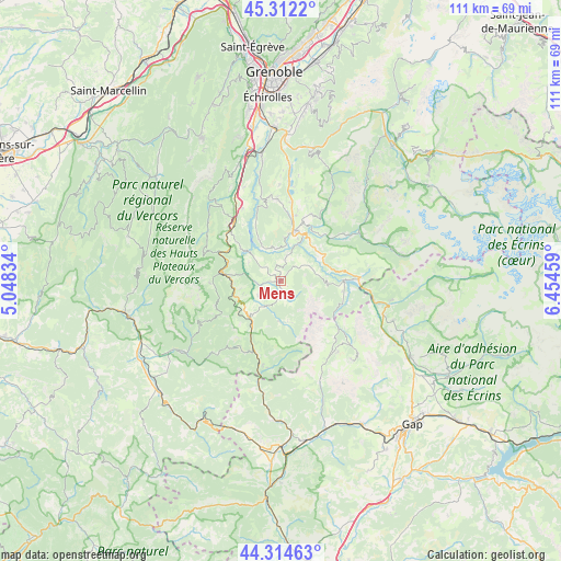
Mens GPS coordinates[2]
44° 48' 56.052" North, 5° 45' 5.256" East
| Map corner | latitude | longitude |
|---|---|---|
| Upper-left | 45.3122°, | 5.04834° |
| Center: | 44.81557°, | 5.75146° |
| Lower-right: | 44.31463°, | 6.45459° |
| Map W x H: | 110.9×110.9 km | = 68.9×68.9mi |
| max Lat: | 51.07786° ⇑81.3% North |
| Mens: | 44.81557° |
| min Lat: | ⇓18.7% South 41.3874° |
| min Long | Mens | max Long |
| -5.08615° | 5.75146° | 9.52242° |
| W 84.7%⇐ | ⇒15.3% E |
Elevation
Elevation of Mens is 868 m = 2848 ft, and this is 674.3 m = 2212 ft above average elevation for this country.
| Max E: |
2333 m = 7654 ft | 1.6% |
| Mens | 868 m 2848 ft | |
| Avg. | 193.7 m = 635 ft | |
Min E: |
-1 m = -3 ft | 98.4% |
See also: France elevation on elevation.city.
Geographical zone
Mens is located in North temperate zone (between Tropic of Cancer and the Arctic Circle). Distance of this Northern Tropic circle is 2377.1 km =1477.1 mi to South.| Distance of | km | miles | from Mens |
|---|---|---|---|
| North Pole | 5024 | 3121.8 | to North |
| Arctic Circle | 2418.1 | 1502.5 | to North |
| Tropic Cancer | 2377.1 | 1477.1 | to South |
| Equator | 4983 | 3096.3 | to South |


Nearby cities:
15 places around Mens: (largest is in red/bold)
• Châtillon-en-Diois
25.8 km =16 mi,  237°
237°
• La Motte-Saint-Martin
15.3 km =9.5 mi,  350°
350°
• La Motte-d’Aveillans
16.1 km =10 mi,  357°
357°
• La Mure
10 km =6.2 mi,  17°
17°
• Le Dévoluy
20.2 km =12.6 mi,  132°
132°
• Le Gua
24.8 km =15.4 mi,  334°
334°
• Monestier-de-Clermont
14.7 km =9.1 mi,  321°
321°
• Notre-Dame-de-Mésage
27.5 km =17.1 mi,  1°
1°
• Pierre-Châtel
15.9 km =9.9 mi,  6°
6°
• Saint-Barthélemy
22.6 km =14 mi, 334°
• Saint-Barthélemy-de-Séchilienne
26.7 km =16.6 mi, 13°
• Saint-Georges-de-Commiers
25.8 km =16 mi, 352°
• Saint-Honoré
15 km =9.3 mi, 19°
• Saint-Pierre-de-Mésage
25.9 km =16.1 mi, 6°
• Sinard
16.2 km =10.1 mi, 332°
Sources, notices
• [Note1] Compared only with cities in France existing in our database
• [Src1] Map data: © OpenStreetMap contributors (CC-BY-SA)
• [Src2] Other city data from geonames.org with taken over terms of usage.
• [Src3] Geographical zone / Annual Mean Temperature by Robert A. Rohde @ Wikipedia
