Mazières-en-Mauges geodata
Mazières-en-Mauges (Pays de la Loire) is a populated place; located in France in Europe/Paris (GMT+2) time zone. With population of 1,023 people, there are 8668 cities with bigger population in this country. Compared to other cities in France, 54.8% of cities are located further ↑North; 86.6% of cities are located further →East and 54.8% of cities have higher elevation than Mazières-en-Mauges. Note1
Administrative division(s):
- Level 1: Pays de la Loire
- Level 2: Département de Maine-et-Loire
- Level 3: Arrondissement de Cholet
- Level 4: Mazières-en-Mauges


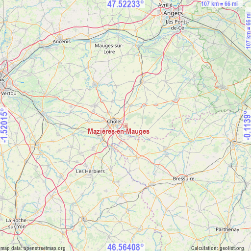
Mazières-en-Mauges GPS coordinates[2]
47° 2' 43.296" North, 0° 49' 1.272" West
| Map corner | latitude | longitude |
|---|---|---|
| Upper-left | 47.52233°, | -1.52015° |
| Center: | 47.04536°, | -0.81702° |
| Lower-right: | 46.56408°, | -0.1139° |
| Map W x H: | 106.5×106.5 km | = 66.2×66.2mi |
| max Lat: | 51.07786° ⇑54.8% North |
| Mazières-en-Mauges: | 47.04536° |
| min Lat: | ⇓45.2% South 41.3874° |
| min Long | Mazières-en-Ma | max Long |
| -5.08615° | -0.81702° | 9.52242° |
| W 13.4%⇐ | ⇒86.6% E |
Elevation
Elevation of Mazières-en-Mauges is 117 m = 384 ft, and this is 76.7 m = 252 ft below average elevation for this country.
| Max E: |
2333 m = 7654 ft | 54.8% |
| Avg. | 193.7 m = 635 ft | |
| Mazières-en-Mauges | 117 m = 384 ft | |
Min E: |
-1 m = -3 ft | 45.2% |
See also: France elevation on elevation.city.
Geographical zone
Mazières-en-Mauges is located in North temperate zone (between Tropic of Cancer and the Arctic Circle). Distance of this North polar circle is 2170.2 km =1348.5 mi to North.| Distance of | km | miles | from Mazières-en-Mauges |
|---|---|---|---|
| North Pole | 4776.1 | 2967.7 | to North |
| Arctic Circle | 2170.2 | 1348.5 | to North |
| Tropic Cancer | 2625 | 1631.1 | to South |
| Equator | 5231 | 3250.4 | to South |


Nearby cities:
15 places around Mazières-en-Mauges: (largest is in red/bold)
• Chanteloup-les-Bois
11.5 km =7.1 mi,  61°
61°
• Cholet
5 km =3.1 mi,  287°
287°
• La Séguinière
9.4 km =5.8 mi,  282°
282°
• La Tessoualle
5.2 km =3.2 mi,  209°
209°
• Maulévrier
6.9 km =4.3 mi,  125°
125°
• Mortagne-sur-Sèvre
11.5 km =7.1 mi,  239°
239°
• Nuaillé
5.8 km =3.6 mi,  16°
16°
• Saint-Christophe-du-Bois
9.8 km =6.1 mi,  260°
260°
• Saint-Laurent-sur-Sèvre
11.3 km =7 mi, 211°
• Saint-Léger-sous-Cholet
8.9 km =5.5 mi,  307°
307°
• Saint-Pierre-des-Échaubrognes
8.3 km =5.2 mi,  138°
138°
• Toutlemonde
4 km =2.5 mi,  74°
74°
• Trémentines
9 km =5.6 mi, 15°
• Vezins
11.6 km =7.2 mi,  44°
44°
• Yzernay
9 km =5.6 mi,  106°
106°
Sources, notices
• [Note1] Compared only with cities in France existing in our database
• [Src1] Map data: © OpenStreetMap contributors (CC-BY-SA)
• [Src2] Other city data from geonames.org with taken over terms of usage.
• [Src3] Geographical zone / Annual Mean Temperature by Robert A. Rohde @ Wikipedia
