Saignes geodata
Saignes (Auvergne-Rhône-Alpes) is a populated place; located in France in Europe/Paris (GMT+2) time zone. With population of 903 people, there are 9626 cities with bigger population in this country. Compared to other cities in France, 76% of cities are located further ↑North; 50.2% of cities are located further ←West and 93.6% of cities have lower elevation than Saignes. Note1
Administrative division(s):
- Level 1: Auvergne-Rhône-Alpes
- Level 2: Cantal
- Level 3: Arrondissement de Mauriac
- Level 4: Saignes


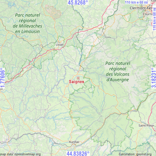
Saignes GPS coordinates[2]
45° 20' 4.884" North, 2° 28' 45.084" East
| Map corner | latitude | longitude |
|---|---|---|
| Upper-left | 45.8268°, | 1.77606° |
| Center: | 45.33469°, | 2.47919° |
| Lower-right: | 44.83826°, | 3.18231° |
| Map W x H: | 109.9×109.9 km | = 68.3×68.3mi |
| max Lat: | 51.07786° ⇑76% North |
| Saignes: | 45.33469° |
| min Lat: | ⇓24% South 41.3874° |
| min Long | Saignes | max Long |
| -5.08615° | 2.47919° | 9.52242° |
| W 50.2%⇐ | ⇒49.8% E |
Elevation
Elevation of Saignes is 527 m = 1729 ft, and this is 333.3 m = 1094 ft above average elevation for this country.
| Max E: |
2333 m = 7654 ft | 6.4% |
| Saignes | 527 m 1729 ft | |
| Avg. | 193.7 m = 635 ft | |
Min E: |
-1 m = -3 ft | 93.6% |
See also: France elevation on elevation.city.
Geographical zone
Saignes is located in North temperate zone (between Tropic of Cancer and the Arctic Circle). Distance of this North polar circle is 2360.4 km =1466.7 mi to North.| Distance of | km | miles | from Saignes |
|---|---|---|---|
| North Pole | 4966.3 | 3085.9 | to North |
| Arctic Circle | 2360.4 | 1466.7 | to North |
| Tropic Cancer | 2434.8 | 1512.9 | to South |
| Equator | 5040.7 | 3132.1 | to South |


Nearby cities:
15 places around Saignes: (largest is in red/bold)
• Anglards-de-Salers
14.8 km =9.2 mi,  191°
191°
• Bort-les-Orgues
7.4 km =4.6 mi,  10°
10°
• Champagnac
6.7 km =4.2 mi,  291°
291°
• Champs-sur-Tarentaine-Marchal
10 km =6.2 mi,  43°
43°
• Condat
21.8 km =13.5 mi,  88°
88°
• Lanobre
12.4 km =7.7 mi,  20°
20°
• Le Vigean
15.5 km =9.6 mi,  219°
219°
• Mauriac
17.2 km =10.7 mi, 221°
• Menet
9.2 km =5.7 mi,  117°
117°
• Neuvic
17.1 km =10.6 mi, 287°
• Riom-ès-Montagnes
15.3 km =9.5 mi,  112°
112°
• Saint-Exupéry-les-Roches
21.9 km =13.6 mi,  337°
337°
• Soursac
22.7 km =14.1 mi,  253°
253°
• Trizac
10.2 km =6.3 mi,  152°
152°
• Ydes
3.6 km =2.2 mi, 293°
Sources, notices
• [Note1] Compared only with cities in France existing in our database
• [Src1] Map data: © OpenStreetMap contributors (CC-BY-SA)
• [Src2] Other city data from geonames.org with taken over terms of usage.
• [Src3] Geographical zone / Annual Mean Temperature by Robert A. Rohde @ Wikipedia
