Capestang geodata
Capestang (Occitanie) is a populated place; located in France in Europe/Paris (GMT+2) time zone. With population of 3,392 people, there are 2871 cities with bigger population in this country. Compared to other cities in France, 95.2% of cities are located further ↑North; 58.4% of cities are located further ←West and 91.6% of cities have higher elevation than Capestang. Note1
Administrative division(s):
- Level 1: Occitanie
- Level 2: Département de l'Hérault
- Level 3: Arrondissement de Béziers
- Level 4: Capestang


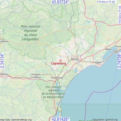
Capestang GPS coordinates[2]
43° 19' 40.476" North, 3° 2' 40.092" East
| Map corner | latitude | longitude |
|---|---|---|
| Upper-left | 43.83724°, | 2.34134° |
| Center: | 43.32791°, | 3.04447° |
| Lower-right: | 42.81428°, | 3.74759° |
| Map W x H: | 113.7×113.7 km | = 70.6×70.6mi |
| max Lat: | 51.07786° ⇑95.2% North |
| Capestang: | 43.32791° |
| min Lat: | ⇓4.8% South 41.3874° |
| min Long | Capestang | max Long |
| -5.08615° | 3.04447° | 9.52242° |
| W 58.4%⇐ | ⇒41.6% E |
Elevation
Elevation of Capestang is 26 m = 85 ft, and this is 167.7 m = 550 ft below average elevation for this country.
| Max E: |
2333 m = 7654 ft | 91.6% |
| Avg. | 193.7 m = 635 ft | |
| Capestang | 26 m = 85 ft | |
Min E: |
-1 m = -3 ft | 8.4% |
See also: France elevation on elevation.city.
Geographical zone
Capestang is located in North temperate zone (between Tropic of Cancer and the Arctic Circle). Distance of this Northern Tropic circle is 2211.7 km =1374.3 mi to South.| Distance of | km | miles | from Capestang |
|---|---|---|---|
| North Pole | 5189.4 | 3224.5 | to North |
| Arctic Circle | 2583.6 | 1605.4 | to North |
| Tropic Cancer | 2211.7 | 1374.3 | to South |
| Equator | 4817.6 | 2993.5 | to South |


Nearby cities:
15 places around Capestang: (largest is in red/bold)
• Argeliers
11 km =6.8 mi,  260°
260°
• Cazouls-lès-Béziers
8.5 km =5.3 mi,  32°
32°
• Colombiers
7.8 km =4.8 mi,  101°
101°
• Coursan
10.5 km =6.5 mi,  174°
174°
• Creissan
5.9 km =3.7 mi,  333°
333°
• Cruzy
8.9 km =5.5 mi,  290°
290°
• Lespignan
12 km =7.5 mi,  120°
120°
• Lignan-sur-Orb
11.9 km =7.4 mi,  57°
57°
• Maraussan
10.1 km =6.3 mi, 63°
• Maureilhan
6.3 km =3.9 mi,  67°
67°
• Montady
6.8 km =4.2 mi,  82°
82°
• Nissan-lez-Enserune
7.9 km =4.9 mi, 122°
• Ouveillan
7.3 km =4.5 mi,  233°
233°
• Puisserguier
4.4 km =2.7 mi,  355°
355°
• Quarante
7 km =4.3 mi, 287°
Sources, notices
• [Note1] Compared only with cities in France existing in our database
• [Src1] Map data: © OpenStreetMap contributors (CC-BY-SA)
• [Src2] Other city data from geonames.org with taken over terms of usage.
• [Src3] Geographical zone / Annual Mean Temperature by Robert A. Rohde @ Wikipedia
