Maulde geodata
Maulde (Hauts-de-France) is a populated place; located in France in Europe/Paris (GMT+2) time zone. With population of 902 people, there are 9633 cities with bigger population in this country. Compared to other cities in France, 97.3% of cities are located further ↓South; 63.6% of cities are located further ←West and 93.6% of cities have higher elevation than Maulde. Note1
Administrative division(s):
- Level 1: Hauts-de-France
- Level 2: Nord
- Level 3: Arrondissement de Valenciennes
- Level 4: Maulde


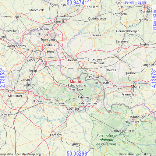
Maulde GPS coordinates[2]
50° 30' 8.28" North, 3° 26' 1.14" East
| Map corner | latitude | longitude |
|---|---|---|
| Upper-left | 50.94741°, | 2.73053° |
| Center: | 50.5023°, | 3.43365° |
| Lower-right: | 50.05296°, | 4.13678° |
| Map W x H: | 99.5×99.5 km | = 61.8×61.8mi |
| max Lat: | 51.07786° ⇑2.7% North |
| Maulde: | 50.5023° |
| min Lat: | ⇓97.3% South 41.3874° |
| min Long | Maulde | max Long |
| -5.08615° | 3.43365° | 9.52242° |
| W 63.6%⇐ | ⇒36.4% E |
Elevation
Elevation of Maulde is 21 m = 69 ft, and this is 172.7 m = 567 ft below average elevation for this country.
| Max E: |
2333 m = 7654 ft | 93.6% |
| Avg. | 193.7 m = 635 ft | |
| Maulde | 21 m = 69 ft | |
Min E: |
-1 m = -3 ft | 6.4% |
See also: France elevation on elevation.city.
Geographical zone
Maulde is located in North temperate zone (between Tropic of Cancer and the Arctic Circle). Distance of this North polar circle is 1785.8 km =1109.6 mi to North.| Distance of | km | miles | from Maulde |
|---|---|---|---|
| North Pole | 4391.7 | 2728.9 | to North |
| Arctic Circle | 1785.8 | 1109.6 | to North |
| Tropic Cancer | 3009.4 | 1870 | to South |
| Equator | 5615.3 | 3489.2 | to South |


Nearby cities:
15 places around Maulde: (largest is in red/bold)
• Bruille-Saint-Amand
6.2 km =3.9 mi,  130°
130°
• Flines-lès-Mortagne
2.2 km =1.4 mi,  88°
88°
• Hasnon
9.2 km =5.7 mi,  201°
201°
• Hergnies
7.3 km =4.5 mi,  116°
116°
• Landas
9.8 km =6.1 mi,  250°
250°
• Lecelles
4.5 km =2.8 mi,  211°
211°
• Millonfosse
8 km =5 mi, 198°
• Mortagne-du-Nord
1.4 km =0.9 mi,  84°
84°
• Mouchin
9.8 km =6.1 mi,  279°
279°
• Odomez
8.4 km =5.2 mi, 130°
• Rosult
7.2 km =4.5 mi,  227°
227°
• Rumegies
6 km =3.7 mi,  255°
255°
• Saint-Amand-les-Eaux
6.1 km =3.8 mi,  181°
181°
• Saméon
7.8 km =4.8 mi,  243°
243°
• Thun-Saint-Amand
3.5 km =2.2 mi,  159°
159°
Sources, notices
• [Note1] Compared only with cities in France existing in our database
• [Src1] Map data: © OpenStreetMap contributors (CC-BY-SA)
• [Src2] Other city data from geonames.org with taken over terms of usage.
• [Src3] Geographical zone / Annual Mean Temperature by Robert A. Rohde @ Wikipedia
