Issoudun geodata
Issoudun (Centre) is a seat of a third-order administrative division; located in France in Europe/Paris (GMT+2) time zone. With population of 14,385 people, there are 665 cities with bigger population in this country. Compared to other cities in France, 55.8% of cities are located further ↑North; 57.2% of cities are located further →East and 53.9% of cities have lower elevation than Issoudun. Note1
Administrative division(s):
- Level 1: Centre
- Level 2: Département de l'Indre
- Level 3: Arrondissement d'Issoudun
- Level 4: Issoudun


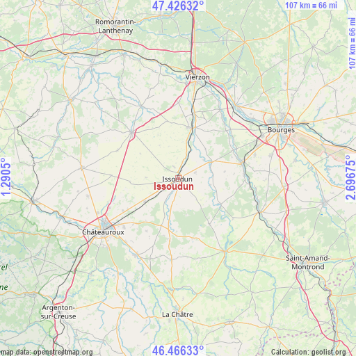
Issoudun GPS coordinates[2]
46° 56' 54.528" North, 1° 59' 37.032" East
| Map corner | latitude | longitude |
|---|---|---|
| Upper-left | 47.42632°, | 1.2905° |
| Center: | 46.94848°, | 1.99362° |
| Lower-right: | 46.46633°, | 2.69675° |
| Map W x H: | 106.7×106.7 km | = 66.3×66.3mi |
| max Lat: | 51.07786° ⇑55.8% North |
| Issoudun: | 46.94848° |
| min Lat: | ⇓44.2% South 41.3874° |
| min Long | Issoudun | max Long |
| -5.08615° | 1.99362° | 9.52242° |
| W 42.8%⇐ | ⇒57.2% E |
Elevation
Elevation of Issoudun is 146 m = 479 ft, and this is 47.7 m = 156 ft below average elevation for this country.
| Max E: |
2333 m = 7654 ft | 46.1% |
| Avg. | 193.7 m = 635 ft | |
| Issoudun | 146 m = 479 ft | |
Min E: |
-1 m = -3 ft | 53.9% |
See also: France elevation on elevation.city.
Geographical zone
Issoudun is located in North temperate zone (between Tropic of Cancer and the Arctic Circle). Distance of this North polar circle is 2181 km =1355.2 mi to North.| Distance of | km | miles | from Issoudun |
|---|---|---|---|
| North Pole | 4786.9 | 2974.4 | to North |
| Arctic Circle | 2181 | 1355.2 | to North |
| Tropic Cancer | 2614.3 | 1624.5 | to South |
| Equator | 5220.2 | 3243.7 | to South |


Nearby cities:
15 places around Issoudun: (largest is in red/bold)
• Ambrault
18.5 km =11.5 mi,  188°
188°
• Chezal-Benoît
16.5 km =10.3 mi,  146°
146°
• Chârost
10.6 km =6.6 mi,  61°
61°
• Civray
13.8 km =8.6 mi,  81°
81°
• Diors
18.4 km =11.4 mi,  223°
223°
• Les Bordes
3.9 km =2.4 mi,  337°
337°
• Mareuil-sur-Arnon
14.8 km =9.2 mi,  120°
120°
• Montierchaume
19.3 km =12 mi,  240°
240°
• Mâron
18.5 km =11.5 mi,  212°
212°
• Neuvy-Pailloux
12.3 km =7.6 mi,  234°
234°
• Pruniers
18.2 km =11.3 mi,  166°
166°
• Reuilly
15.6 km =9.7 mi,  13°
13°
• Saint-Florent-sur-Cher
20.2 km =12.6 mi,  74°
74°
• Sainte-Lizaigne
6.9 km =4.3 mi,  18°
18°
• Vatan
19.7 km =12.2 mi,  315°
315°
Sources, notices
• [Note1] Compared only with cities in France existing in our database
• [Src1] Map data: © OpenStreetMap contributors (CC-BY-SA)
• [Src2] Other city data from geonames.org with taken over terms of usage.
• [Src3] Geographical zone / Annual Mean Temperature by Robert A. Rohde @ Wikipedia
