Manom geodata
Manom (Grand Est) is a populated place; located in France in Europe/Paris (GMT+2) time zone. With population of 2,822 people, there are 3455 cities with bigger population in this country. Compared to other cities in France, 87.4% of cities are located further ↓South; 89.1% of cities are located further ←West and 55% of cities have lower elevation than Manom. Note1
Administrative division(s):
- Level 1: Grand Est
- Level 2: Moselle
- Level 3: Arrondissement de Thionville
- Level 4: Manom


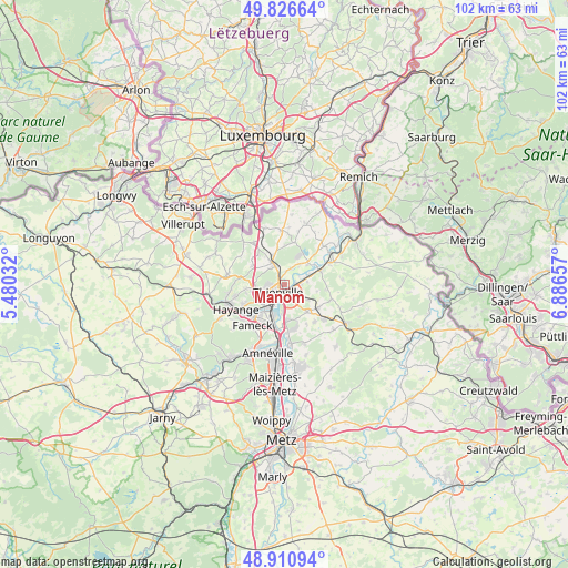
Manom GPS coordinates[2]
49° 22' 15.312" North, 6° 11' 0.42" East
| Map corner | latitude | longitude |
|---|---|---|
| Upper-left | 49.82664°, | 5.48032° |
| Center: | 49.37092°, | 6.18345° |
| Lower-right: | 48.91094°, | 6.88657° |
| Map W x H: | 101.8×101.8 km | = 63.3×63.3mi |
| max Lat: | 51.07786° ⇑12.6% North |
| Manom: | 49.37092° |
| min Lat: | ⇓87.4% South 41.3874° |
| min Long | Manom | max Long |
| -5.08615° | 6.18345° | 9.52242° |
| W 89.1%⇐ | ⇒10.9% E |
Elevation
Elevation of Manom is 150 m = 492 ft, and this is 43.7 m = 143 ft below average elevation for this country.
| Max E: |
2333 m = 7654 ft | 45% |
| Avg. | 193.7 m = 635 ft | |
| Manom | 150 m = 492 ft | |
Min E: |
-1 m = -3 ft | 55% |
See also: France elevation on elevation.city.
Geographical zone
Manom is located in North temperate zone (between Tropic of Cancer and the Arctic Circle). Distance of this North polar circle is 1911.6 km =1187.8 mi to North.| Distance of | km | miles | from Manom |
|---|---|---|---|
| North Pole | 4517.5 | 2807 | to North |
| Arctic Circle | 1911.6 | 1187.8 | to North |
| Tropic Cancer | 2883.6 | 1791.8 | to South |
| Equator | 5489.5 | 3411 | to South |


Nearby cities:
15 places around Manom: (largest is in red/bold)
• Basse-Ham
4.6 km =2.9 mi,  68°
68°
• Bertrange
6.4 km =4 mi,  174°
174°
• Boust
7.2 km =4.5 mi,  4°
4°
• Cattenom
5.8 km =3.6 mi,  47°
47°
• Distroff
7.4 km =4.6 mi,  125°
125°
• Elzange
7.5 km =4.7 mi,  97°
97°
• Entrange
7.4 km =4.6 mi,  309°
309°
• Florange
6.9 km =4.3 mi,  220°
220°
• Hettange-Grande
4.6 km =2.9 mi,  330°
330°
• Illange
5 km =3.1 mi,  183°
183°
• Kuntzig
4.7 km =2.9 mi,  124°
124°
• Stuckange
6.3 km =3.9 mi,  141°
141°
• Terville
4.5 km =2.8 mi,  233°
233°
• Thionville
2.1 km =1.3 mi, 233°
• Yutz
1.8 km =1.1 mi,  158°
158°
Sources, notices
• [Note1] Compared only with cities in France existing in our database
• [Src1] Map data: © OpenStreetMap contributors (CC-BY-SA)
• [Src2] Other city data from geonames.org with taken over terms of usage.
• [Src3] Geographical zone / Annual Mean Temperature by Robert A. Rohde @ Wikipedia
