Sombernon geodata
Sombernon (Bourgogne-Franche-Comté) is a populated place; located in France in Europe/Paris (GMT+2) time zone. With population of 806 people, there are 10540 cities with bigger population in this country. Compared to other cities in France, 51.4% of cities are located further ↑North; 73.9% of cities are located further ←West and 94.7% of cities have lower elevation than Sombernon. Note1
Administrative division(s):
- Level 1: Bourgogne-Franche-Comté
- Level 2: Département de la Côte-d'Or
- Level 3: Arrondissement de Dijon
- Level 4: Sombernon


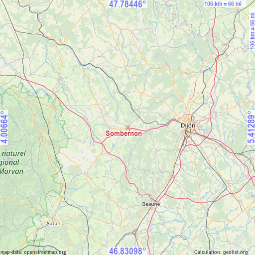
Sombernon GPS coordinates[2]
47° 18' 35.532" North, 4° 42' 35.136" East
| Map corner | latitude | longitude |
|---|---|---|
| Upper-left | 47.78446°, | 4.00664° |
| Center: | 47.30987°, | 4.70976° |
| Lower-right: | 46.83098°, | 5.41289° |
| Map W x H: | 106×106 km | = 65.9×65.9mi |
| max Lat: | 51.07786° ⇑51.4% North |
| Sombernon: | 47.30987° |
| min Lat: | ⇓48.6% South 41.3874° |
| min Long | Sombernon | max Long |
| -5.08615° | 4.70976° | 9.52242° |
| W 73.9%⇐ | ⇒26.1% E |
Elevation
Elevation of Sombernon is 566 m = 1857 ft, and this is 372.3 m = 1221 ft above average elevation for this country.
| Max E: |
2333 m = 7654 ft | 5.3% |
| Sombernon | 566 m 1857 ft | |
| Avg. | 193.7 m = 635 ft | |
Min E: |
-1 m = -3 ft | 94.7% |
See also: France elevation on elevation.city.
Geographical zone
Sombernon is located in North temperate zone (between Tropic of Cancer and the Arctic Circle). Distance of this North polar circle is 2140.8 km =1330.2 mi to North.| Distance of | km | miles | from Sombernon |
|---|---|---|---|
| North Pole | 4746.7 | 2949.5 | to North |
| Arctic Circle | 2140.8 | 1330.2 | to North |
| Tropic Cancer | 2654.4 | 1649.4 | to South |
| Equator | 5260.4 | 3268.7 | to South |


Nearby cities:
15 places around Sombernon: (largest is in red/bold)
• Blaisy-Bas
7.1 km =4.4 mi,  17°
17°
• Brochon
21.1 km =13.1 mi,  112°
112°
• Corcelles-les-Monts
17.5 km =10.9 mi,  95°
95°
• Couchey
21.3 km =13.2 mi, 105°
• Fixin
21.1 km =13.1 mi, 109°
• Fleurey-sur-Ouche
11.3 km =7 mi,  88°
88°
• Gevrey-Chambertin
21.6 km =13.4 mi,  115°
115°
• Hauteville-lès-Dijon
22.3 km =13.9 mi,  73°
73°
• Marsannay-la-Côte
21.5 km =13.4 mi, 101°
• Mâlain
6.9 km =4.3 mi, 74°
• Plombières-lès-Dijon
19.5 km =12.1 mi,  82°
82°
• Pouilly-en-Auxois
12.8 km =8 mi,  245°
245°
• Sainte-Marie-sur-Ouche
7 km =4.3 mi, 111°
• Velars-sur-Ouche
14.8 km =9.2 mi, 85°
• Vitteaux
16 km =9.9 mi,  307°
307°
Sources, notices
• [Note1] Compared only with cities in France existing in our database
• [Src1] Map data: © OpenStreetMap contributors (CC-BY-SA)
• [Src2] Other city data from geonames.org with taken over terms of usage.
• [Src3] Geographical zone / Annual Mean Temperature by Robert A. Rohde @ Wikipedia
