Luxé geodata
Luxé (Nouvelle-Aquitaine) is a populated place; located in France in Europe/Paris (GMT+2) time zone. With population of 771 people, there are 10923 cities with bigger population in this country. Compared to other cities in France, 67.7% of cities are located further ↑North; 77.1% of cities are located further →East and 71.4% of cities have higher elevation than Luxé. Note1
Administrative division(s):
- Level 1: Nouvelle-Aquitaine
- Level 2: Charente
- Level 3: Arrondissement de Confolens
- Level 4: Luxé


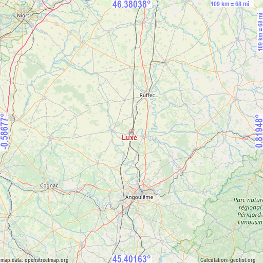
Luxé GPS coordinates[2]
45° 53' 35.376" North, 0° 6' 58.86" East
| Map corner | latitude | longitude |
|---|---|---|
| Upper-left | 46.38038°, | -0.58677° |
| Center: | 45.89316°, | 0.11635° |
| Lower-right: | 45.40163°, | 0.81948° |
| Map W x H: | 108.8×108.8 km | = 67.6×67.6mi |
| max Lat: | 51.07786° ⇑67.7% North |
| Luxé: | 45.89316° |
| min Lat: | ⇓32.3% South 41.3874° |
| min Long | Luxé | max Long |
| -5.08615° | 0.11635° | 9.52242° |
| W 22.9%⇐ | ⇒77.1% E |
Elevation
Elevation of Luxé is 75 m = 246 ft, and this is 118.7 m = 389 ft below average elevation for this country.
| Max E: |
2333 m = 7654 ft | 71.4% |
| Avg. | 193.7 m = 635 ft | |
| Luxé | 75 m = 246 ft | |
Min E: |
-1 m = -3 ft | 28.6% |
See also: France elevation on elevation.city.
Geographical zone
Luxé is located in North temperate zone (between Tropic of Cancer and the Arctic Circle). Distance of this North polar circle is 2298.3 km =1428.1 mi to North.| Distance of | km | miles | from Luxé |
|---|---|---|---|
| North Pole | 4904.2 | 3047.3 | to North |
| Arctic Circle | 2298.3 | 1428.1 | to North |
| Tropic Cancer | 2496.9 | 1551.5 | to South |
| Equator | 5102.8 | 3170.7 | to South |


Nearby cities:
15 places around Luxé: (largest is in red/bold)
• Aigre
8.3 km =5.2 mi,  270°
270°
• Anais
15 km =9.3 mi,  151°
151°
• Genac
12.8 km =8 mi,  213°
213°
• Gourville
12.4 km =7.7 mi,  235°
235°
• La Faye
14.3 km =8.9 mi,  9°
9°
• Mansle
5.3 km =3.3 mi,  112°
112°
• Marcillac-Lanville
9.1 km =5.7 mi,  234°
234°
• Montignac-Charente
12.2 km =7.6 mi,  177°
177°
• Saint-Amant-de-Boixe
10.7 km =6.6 mi,  172°
172°
• Saint-Angeau
14.1 km =8.8 mi, 110°
• Tourriers
12.2 km =7.6 mi, 151°
• Vars
14.5 km =9 mi, 177°
• Verteuil-sur-Charente
13.2 km =8.2 mi,  42°
42°
• Villefagnan
13.5 km =8.4 mi,  347°
347°
• Villejésus
6.7 km =4.2 mi, 271°
Sources, notices
• [Note1] Compared only with cities in France existing in our database
• [Src1] Map data: © OpenStreetMap contributors (CC-BY-SA)
• [Src2] Other city data from geonames.org with taken over terms of usage.
• [Src3] Geographical zone / Annual Mean Temperature by Robert A. Rohde @ Wikipedia
