Villefagnan geodata
Villefagnan (Nouvelle-Aquitaine) is a populated place; located in France in Europe/Paris (GMT+2) time zone. With population of 1,077 people, there are 8279 cities with bigger population in this country. Compared to other cities in France, 66.1% of cities are located further ↑North; 77.4% of cities are located further →East and 54.1% of cities have higher elevation than Villefagnan. Note1
Administrative division(s):
- Level 1: Nouvelle-Aquitaine
- Level 2: Charente
- Level 3: Arrondissement de Confolens
- Level 4: Villefagnan


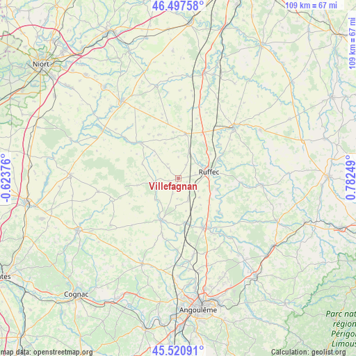
Villefagnan GPS coordinates[2]
46° 0' 41.04" North, 0° 4' 45.696" East
| Map corner | latitude | longitude |
|---|---|---|
| Upper-left | 46.49758°, | -0.62376° |
| Center: | 46.0114°, | 0.07936° |
| Lower-right: | 45.52091°, | 0.78249° |
| Map W x H: | 108.6×108.6 km | = 67.5×67.5mi |
| max Lat: | 51.07786° ⇑66.1% North |
| Villefagnan: | 46.0114° |
| min Lat: | ⇓33.9% South 41.3874° |
| min Long | Villefagnan | max Long |
| -5.08615° | 0.07936° | 9.52242° |
| W 22.6%⇐ | ⇒77.4% E |
Elevation
Elevation of Villefagnan is 119 m = 390 ft, and this is 74.7 m = 245 ft below average elevation for this country.
| Max E: |
2333 m = 7654 ft | 54.1% |
| Avg. | 193.7 m = 635 ft | |
| Villefagnan | 119 m = 390 ft | |
Min E: |
-1 m = -3 ft | 45.9% |
See also: France elevation on elevation.city.
Geographical zone
Villefagnan is located in North temperate zone (between Tropic of Cancer and the Arctic Circle). Distance of this North polar circle is 2285.2 km =1420 mi to North.| Distance of | km | miles | from Villefagnan |
|---|---|---|---|
| North Pole | 4891.1 | 3039.2 | to North |
| Arctic Circle | 2285.2 | 1420 | to North |
| Tropic Cancer | 2510.1 | 1559.7 | to South |
| Equator | 5116 | 3178.9 | to South |


Nearby cities:
15 places around Villefagnan: (largest is in red/bold)
• Aigre
14.1 km =8.8 mi,  202°
202°
• Chef-Boutonne
15.8 km =9.8 mi,  313°
313°
• Gournay-Loizé
18.4 km =11.4 mi,  327°
327°
• La Faye
5.2 km =3.2 mi,  79°
79°
• Limalonges
14.9 km =9.3 mi,  27°
27°
• Luxé
13.5 km =8.4 mi,  167°
167°
• Mansle
17 km =10.6 mi,  152°
152°
• Marcillac-Lanville
19 km =11.8 mi,  193°
193°
• Melleran
14.6 km =9.1 mi,  335°
335°
• Nanteuil-en-Vallée
18.8 km =11.7 mi,  93°
93°
• Ruffec
9.4 km =5.8 mi, 78°
• Sauzé-Vaussais
13.8 km =8.6 mi,  8°
8°
• Taizé-Aizie
13.5 km =8.4 mi,  63°
63°
• Verteuil-sur-Charente
12.2 km =7.6 mi,  106°
106°
• Villejésus
13.5 km =8.4 mi, 196°
Sources, notices
• [Note1] Compared only with cities in France existing in our database
• [Src1] Map data: © OpenStreetMap contributors (CC-BY-SA)
• [Src2] Other city data from geonames.org with taken over terms of usage.
• [Src3] Geographical zone / Annual Mean Temperature by Robert A. Rohde @ Wikipedia
