Baudres geodata
Baudres (Centre) is a populated place; located in France in Europe/Paris (GMT+2) time zone. With population of 501 people, there are 15224 cities with bigger population in this country. Compared to other cities in France, 54.7% of cities are located further ↑North; 62% of cities are located further →East and 53.6% of cities have lower elevation than Baudres. Note1
Administrative division(s):
- Level 1: Centre
- Level 2: Département de l'Indre
- Level 3: Arrondissement de Châteauroux
- Level 4: Baudres


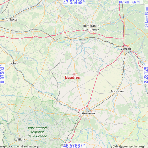
Baudres GPS coordinates[2]
47° 3' 28.188" North, 1° 34' 41.376" East
| Map corner | latitude | longitude |
|---|---|---|
| Upper-left | 47.53469°, | 0.87503° |
| Center: | 47.05783°, | 1.57816° |
| Lower-right: | 46.57667°, | 2.28129° |
| Map W x H: | 106.5×106.5 km | = 66.2×66.2mi |
| max Lat: | 51.07786° ⇑54.7% North |
| Baudres: | 47.05783° |
| min Lat: | ⇓45.3% South 41.3874° |
| min Long | Baudres | max Long |
| -5.08615° | 1.57816° | 9.52242° |
| W 38%⇐ | ⇒62% E |
Elevation
Elevation of Baudres is 145 m = 476 ft, and this is 48.7 m = 160 ft below average elevation for this country.
| Max E: |
2333 m = 7654 ft | 46.4% |
| Avg. | 193.7 m = 635 ft | |
| Baudres | 145 m = 476 ft | |
Min E: |
-1 m = -3 ft | 53.6% |
See also: France elevation on elevation.city.
Geographical zone
Baudres is located in North temperate zone (between Tropic of Cancer and the Arctic Circle). Distance of this North polar circle is 2168.8 km =1347.6 mi to North.| Distance of | km | miles | from Baudres |
|---|---|---|---|
| North Pole | 4774.7 | 2966.9 | to North |
| Arctic Circle | 2168.8 | 1347.6 | to North |
| Tropic Cancer | 2626.4 | 1632 | to South |
| Equator | 5232.3 | 3251.2 | to South |


Nearby cities:
15 places around Baudres: (largest is in red/bold)
• Argy
16.8 km =10.4 mi,  219°
219°
• Coings
21.7 km =13.5 mi,  151°
151°
• La Vernelle
21.4 km =13.3 mi,  352°
352°
• Levroux
9.2 km =5.7 mi,  163°
163°
• Luçay-le-Mâle
13.1 km =8.1 mi,  307°
307°
• Lye
20.5 km =12.7 mi,  337°
337°
• Pellevoisin
14.8 km =9.2 mi,  235°
235°
• Poulaines
12.3 km =7.6 mi,  31°
31°
• Valençay
11.6 km =7.2 mi,  356°
356°
• Varennes-sur-Fouzon
17.4 km =10.8 mi,  6°
6°
• Vatan
17.7 km =11 mi,  83°
83°
• Vicq-sur-Nahon
6.2 km =3.9 mi,  330°
330°
• Villentrois
17.5 km =10.9 mi, 330°
• Vineuil
18 km =11.2 mi,  166°
166°
• Écueillé
17.8 km =11.1 mi,  279°
279°
Sources, notices
• [Note1] Compared only with cities in France existing in our database
• [Src1] Map data: © OpenStreetMap contributors (CC-BY-SA)
• [Src2] Other city data from geonames.org with taken over terms of usage.
• [Src3] Geographical zone / Annual Mean Temperature by Robert A. Rohde @ Wikipedia
