Lourdoueix-Saint-Pierre geodata
Lourdoueix-Saint-Pierre (Nouvelle-Aquitaine) is a populated place; located in France in Europe/Paris (GMT+2) time zone. With population of 918 people, there are 9502 cities with bigger population in this country. Compared to other cities in France, 60.9% of cities are located further ↑North; 59.2% of cities are located further →East and 87.1% of cities have lower elevation than Lourdoueix-Saint-Pierre. Note1
Administrative division(s):
- Level 1: Nouvelle-Aquitaine
- Level 2: Creuse
- Level 3: Arrondissement de Guéret
- Level 4: Lourdoueix-Saint-Pierre
Current local time in Lourdoueix-Saint-Pierre:
01:38 PM, WednesdayDifference from your time zone: hours


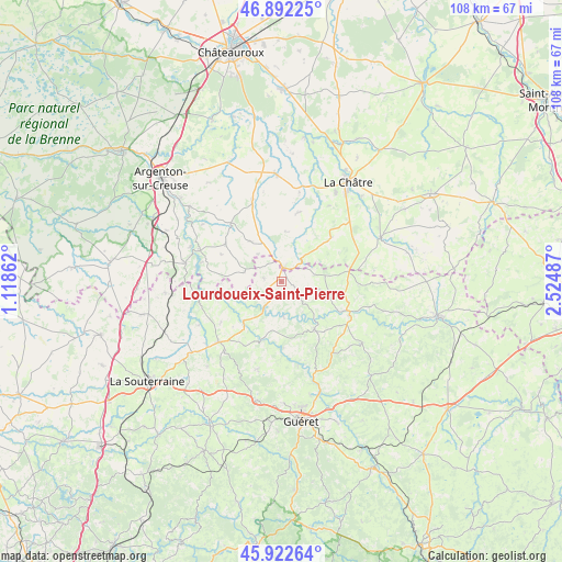
Lourdoueix-Saint-Pierre GPS coordinates[2]
46° 24' 34.56" North, 1° 49' 18.264" East
| Map corner | latitude | longitude |
|---|---|---|
| Upper-left | 46.89225°, | 1.11862° |
| Center: | 46.4096°, | 1.82174° |
| Lower-right: | 45.92264°, | 2.52487° |
| Map W x H: | 107.8×107.8 km | = 67×67mi |
| max Lat: | 51.07786° ⇑60.9% North |
| Lourdoueix-Saint-Pierre: | 46.4096° |
| min Lat: | ⇓39.1% South 41.3874° |
| min Long | Lourdoueix-Sain | max Long |
| -5.08615° | 1.82174° | 9.52242° |
| W 40.8%⇐ | ⇒59.2% E |
Elevation
Elevation of Lourdoueix-Saint-Pierre is 375 m = 1230 ft, and this is 181.3 m = 595 ft above average elevation for this country.
| Max E: |
2333 m = 7654 ft | 12.9% |
| Lourdoueix-Saint-Pierre | 375 m 1230 ft | |
| Avg. | 193.7 m = 635 ft | |
Min E: |
-1 m = -3 ft | 87.1% |
See also: France elevation on elevation.city.
Geographical zone
Lourdoueix-Saint-Pierre is located in North temperate zone (between Tropic of Cancer and the Arctic Circle). Distance of this North polar circle is 2240.9 km =1392.4 mi to North.| Distance of | km | miles | from Lourdoueix-Saint-Pierre |
|---|---|---|---|
| North Pole | 4846.8 | 3011.7 | to North |
| Arctic Circle | 2240.9 | 1392.4 | to North |
| Tropic Cancer | 2554.3 | 1587.2 | to South |
| Equator | 5160.3 | 3206.5 | to South |


Nearby cities:
15 places around Lourdoueix-Saint-Pierre: (largest is in red/bold)
• Aigurande
2.8 km =1.7 mi,  13°
13°
• Anzême
16.2 km =10.1 mi,  168°
168°
• Bonnat
11.1 km =6.9 mi,  145°
145°
• Chéniers
6.5 km =4 mi,  175°
175°
• Cluis
16 km =9.9 mi,  339°
339°
• Crozant
15.5 km =9.6 mi,  262°
262°
• Dun-le-Palestel
16.6 km =10.3 mi,  226°
226°
• Fresselines
11.1 km =6.9 mi,  254°
254°
• Genouillac
14.6 km =9.1 mi,  116°
116°
• La Celle-Dunoise
11.9 km =7.4 mi,  198°
198°
• Montchevrier
10 km =6.2 mi,  322°
322°
• Moutier-Malcard
9.6 km =6 mi,  100°
100°
• Méasnes
3.5 km =2.2 mi,  282°
282°
• Orsennes
13 km =8.1 mi,  304°
304°
• Saint-Sulpice-le-Dunois
14.1 km =8.8 mi,  210°
210°
Sources, notices
• [Note1] Compared only with cities in France existing in our database
• [Src1] Map data: © OpenStreetMap contributors (CC-BY-SA)
• [Src2] Other city data from geonames.org with taken over terms of usage.
• [Src3] Geographical zone / Annual Mean Temperature by Robert A. Rohde @ Wikipedia
