La Celle-Dunoise geodata
La Celle-Dunoise (Nouvelle-Aquitaine) is a populated place; located in France in Europe/Paris (GMT+2) time zone. With population of 613 people, there are 13109 cities with bigger population in this country. Compared to other cities in France, 62.2% of cities are located further ↑North; 59.7% of cities are located further →East and 72.4% of cities have lower elevation than La Celle-Dunoise. Note1
Administrative division(s):
- Level 1: Nouvelle-Aquitaine
- Level 2: Creuse
- Level 3: Arrondissement de Guéret
- Level 4: La Celle-Dunoise


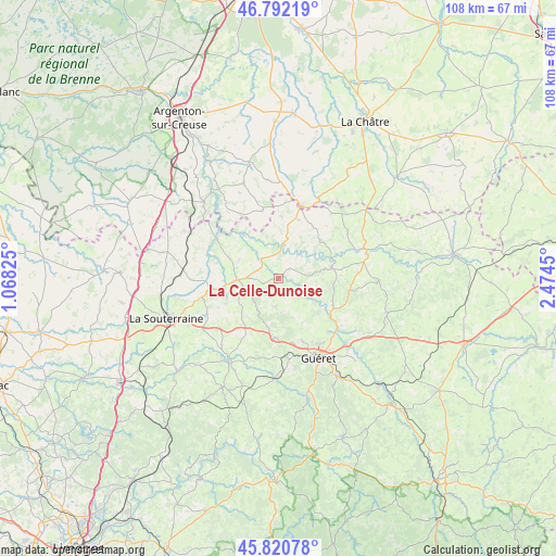
La Celle-Dunoise GPS coordinates[2]
46° 18' 31.104" North, 1° 46' 16.932" East
| Map corner | latitude | longitude |
|---|---|---|
| Upper-left | 46.79219°, | 1.06825° |
| Center: | 46.30864°, | 1.77137° |
| Lower-right: | 45.82078°, | 2.4745° |
| Map W x H: | 108×108 km | = 67.1×67.1mi |
| max Lat: | 51.07786° ⇑62.2% North |
| La Celle-Dunoise: | 46.30864° |
| min Lat: | ⇓37.8% South 41.3874° |
| min Long | La Celle-Dunois | max Long |
| -5.08615° | 1.77137° | 9.52242° |
| W 40.3%⇐ | ⇒59.7% E |
Elevation
Elevation of La Celle-Dunoise is 232 m = 761 ft, and this is 38.3 m = 126 ft above average elevation for this country.
| Max E: |
2333 m = 7654 ft | 27.6% |
| La Celle-Dunoise | 232 m 761 ft | |
| Avg. | 193.7 m = 635 ft | |
Min E: |
-1 m = -3 ft | 72.4% |
See also: France elevation on elevation.city.
Geographical zone
La Celle-Dunoise is located in North temperate zone (between Tropic of Cancer and the Arctic Circle). Distance of this North polar circle is 2252.1 km =1399.4 mi to North.| Distance of | km | miles | from La Celle-Dunoise |
|---|---|---|---|
| North Pole | 4858 | 3018.6 | to North |
| Arctic Circle | 2252.1 | 1399.4 | to North |
| Tropic Cancer | 2543.1 | 1580.2 | to South |
| Equator | 5149 | 3199.4 | to South |


Nearby cities:
15 places around La Celle-Dunoise: (largest is in red/bold)
• Aigurande
14.6 km =9.1 mi,  17°
17°
• Anzême
8.5 km =5.3 mi,  123°
123°
• Bonnat
10.4 km =6.5 mi,  78°
78°
• Bussière-Dunoise
5.6 km =3.5 mi,  187°
187°
• Chéniers
6.4 km =4 mi,  42°
42°
• Crozant
14.8 km =9.2 mi,  308°
308°
• Dun-le-Palestel
8.1 km =5 mi,  268°
268°
• Fresselines
10.7 km =6.6 mi,  320°
320°
• Lourdoueix-Saint-Pierre
11.9 km =7.4 mi, 18°
• Méasnes
12 km =7.5 mi,  2°
2°
• Naillat
11.4 km =7.1 mi,  244°
244°
• Saint-Fiel
14.1 km =8.8 mi,  137°
137°
• Saint-Sulpice-le-Dunois
3.4 km =2.1 mi,  252°
252°
• Saint-Sulpice-le-Guérétois
12.8 km =8 mi,  159°
159°
• Saint-Vaury
11.7 km =7.3 mi, 185°
Sources, notices
• [Note1] Compared only with cities in France existing in our database
• [Src1] Map data: © OpenStreetMap contributors (CC-BY-SA)
• [Src2] Other city data from geonames.org with taken over terms of usage.
• [Src3] Geographical zone / Annual Mean Temperature by Robert A. Rohde @ Wikipedia
