Saint-Laurent-de-Céris geodata
Saint-Laurent-de-Céris (Nouvelle-Aquitaine) is a populated place; located in France in Europe/Paris (GMT+2) time zone. With population of 773 people, there are 10903 cities with bigger population in this country. Compared to other cities in France, 67% of cities are located further ↑North; 73.6% of cities are located further →East and 57.1% of cities have lower elevation than Saint-Laurent-de-Céris. Note1
Administrative division(s):
- Level 1: Nouvelle-Aquitaine
- Level 2: Charente
- Level 3: Arrondissement de Confolens
- Level 4: Saint-Laurent-de-Céris
Current local time in Saint-Laurent-de-Céris:
02:30 PM, SaturdayDifference from your time zone: hours


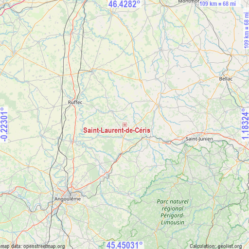
Saint-Laurent-de-Céris GPS coordinates[2]
45° 56' 29.076" North, 0° 28' 48.396" East
| Map corner | latitude | longitude |
|---|---|---|
| Upper-left | 46.4282°, | -0.22301° |
| Center: | 45.94141°, | 0.48011° |
| Lower-right: | 45.45031°, | 1.18324° |
| Map W x H: | 108.7×108.7 km | = 67.5×67.5mi |
| max Lat: | 51.07786° ⇑67% North |
| Saint-Laurent-de-Céris: | 45.94141° |
| min Lat: | ⇓33% South 41.3874° |
| min Long | Saint-Laurent-d | max Long |
| -5.08615° | 0.48011° | 9.52242° |
| W 26.4%⇐ | ⇒73.6% E |
Elevation
Elevation of Saint-Laurent-de-Céris is 158 m = 518 ft, and this is 35.7 m = 117 ft below average elevation for this country.
| Max E: |
2333 m = 7654 ft | 42.9% |
| Avg. | 193.7 m = 635 ft | |
| Saint-Laurent-de-Céris | 158 m = 518 ft | |
Min E: |
-1 m = -3 ft | 57.1% |
See also: France elevation on elevation.city.
Geographical zone
Saint-Laurent-de-Céris is located in North temperate zone (between Tropic of Cancer and the Arctic Circle). Distance of this North polar circle is 2293 km =1424.8 mi to North.| Distance of | km | miles | from Saint-Laurent-de-Céris |
|---|---|---|---|
| North Pole | 4898.9 | 3044 | to North |
| Arctic Circle | 2293 | 1424.8 | to North |
| Tropic Cancer | 2502.3 | 1554.9 | to South |
| Equator | 5108.2 | 3174.1 | to South |


Nearby cities:
15 places around Saint-Laurent-de-Céris: (largest is in red/bold)
• Alloue
10.6 km =6.6 mi,  15°
15°
• Ansac-sur-Vienne
14 km =8.7 mi,  65°
65°
• Champagne-Mouton
7.7 km =4.8 mi,  315°
315°
• Chasseneuil-sur-Bonnieure
14.1 km =8.8 mi,  189°
189°
• Chirac
13.9 km =8.6 mi,  102°
102°
• Confolens
16.9 km =10.5 mi,  61°
61°
• Exideuil
16.1 km =10 mi,  112°
112°
• Genouillac
12.1 km =7.5 mi,  144°
144°
• Loubert
8.7 km =5.4 mi, 110°
• Manot
12.2 km =7.6 mi,  89°
89°
• Nanteuil-en-Vallée
13.9 km =8.6 mi,  298°
298°
• Nieuil
7.2 km =4.5 mi,  166°
166°
• Roumazières-Loubert
9.9 km =6.2 mi,  127°
127°
• Saint-Claud
5.3 km =3.3 mi, 193°
• Vitrac-Saint-Vincent
16.2 km =10.1 mi,  176°
176°
Sources, notices
• [Note1] Compared only with cities in France existing in our database
• [Src1] Map data: © OpenStreetMap contributors (CC-BY-SA)
• [Src2] Other city data from geonames.org with taken over terms of usage.
• [Src3] Geographical zone / Annual Mean Temperature by Robert A. Rohde @ Wikipedia
