Longpré-les-Corps-Saints geodata
Longpré-les-Corps-Saints (Hauts-de-France) is a populated place; located in France in Europe/Paris (GMT+2) time zone. With population of 1,591 people, there are 5863 cities with bigger population in this country. Compared to other cities in France, 93.6% of cities are located further ↓South; 57.2% of cities are located further →East and 96% of cities have higher elevation than Longpré-les-Corps-Saints. Note1
Administrative division(s):
- Level 1: Hauts-de-France
- Level 2: Somme
- Level 3: Abbeville
- Level 4: Longpré-les-Corps-Saints
Current local time in Longpré-les-Corps-Saints:
02:16 AM, SaturdayDifference from your time zone: hours


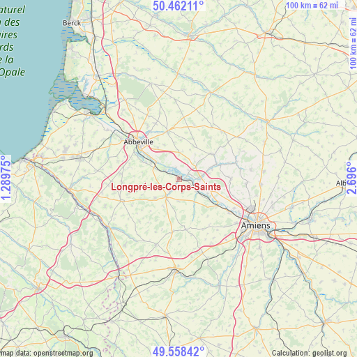
Longpré-les-Corps-Saints GPS coordinates[2]
50° 0' 44.604" North, 1° 59' 34.332" East
| Map corner | latitude | longitude |
|---|---|---|
| Upper-left | 50.46211°, | 1.28975° |
| Center: | 50.01239°, | 1.99287° |
| Lower-right: | 49.55842°, | 2.696° |
| Map W x H: | 100.5×100.5 km | = 62.4×62.4mi |
| max Lat: | 51.07786° ⇑6.4% North |
| Longpré-les-Corps-Saints: | 50.01239° |
| min Lat: | ⇓93.6% South 41.3874° |
| min Long | Longpré-les-Co | max Long |
| -5.08615° | 1.99287° | 9.52242° |
| W 42.8%⇐ | ⇒57.2% E |
Elevation
Elevation of Longpré-les-Corps-Saints is 14 m = 46 ft, and this is 179.7 m = 590 ft below average elevation for this country.
| Max E: |
2333 m = 7654 ft | 96% |
| Avg. | 193.7 m = 635 ft | |
| Longpré-les-Corps-Saints | 14 m = 46 ft | |
Min E: |
-1 m = -3 ft | 4% |
See also: France elevation on elevation.city.
Geographical zone
Longpré-les-Corps-Saints is located in North temperate zone (between Tropic of Cancer and the Arctic Circle). Distance of this North polar circle is 1840.3 km =1143.5 mi to North.| Distance of | km | miles | from Longpré-les-Corps-Saints |
|---|---|---|---|
| North Pole | 4446.2 | 2762.7 | to North |
| Arctic Circle | 1840.3 | 1143.5 | to North |
| Tropic Cancer | 2954.9 | 1836.1 | to South |
| Equator | 5560.9 | 3455.4 | to South |


Nearby cities:
15 places around Longpré-les-Corps-Saints: (largest is in red/bold)
• Ailly-le-Haut-Clocher
7.4 km =4.6 mi,  0°
0°
• Airaines
6.1 km =3.8 mi,  216°
216°
• Allery
8.6 km =5.3 mi,  231°
231°
• Berteaucourt-les-Dames
12.4 km =7.7 mi,  71°
71°
• Condé-Folie
1.4 km =0.9 mi,  105°
105°
• Domart-en-Ponthieu
11.7 km =7.3 mi,  54°
54°
• Flixecourt
6.3 km =3.9 mi,  87°
87°
• Hallencourt
8.6 km =5.3 mi,  254°
254°
• Hangest-sur-Somme
6.2 km =3.9 mi,  124°
124°
• Long
3.3 km =2.1 mi,  343°
343°
• Pont-Remy
6.9 km =4.3 mi,  307°
307°
• Saint-Léger-lès-Domart
11.4 km =7.1 mi, 67°
• Saint-Ouen
9.6 km =6 mi, 72°
• Vauchelles-les-Quesnoy
12.5 km =7.8 mi,  321°
321°
• Épagne-Épagnette
10.8 km =6.7 mi, 307°
Sources, notices
• [Note1] Compared only with cities in France existing in our database
• [Src1] Map data: © OpenStreetMap contributors (CC-BY-SA)
• [Src2] Other city data from geonames.org with taken over terms of usage.
• [Src3] Geographical zone / Annual Mean Temperature by Robert A. Rohde @ Wikipedia
