Lohr geodata
Lohr (Grand Est) is a populated place; located in France in Europe/Paris (GMT+2) time zone. With population of 551 people, there are 14194 cities with bigger population in this country. Compared to other cities in France, 76.8% of cities are located further ↓South; 96.1% of cities are located further ←West and 85.2% of cities have lower elevation than Lohr. Note1
Administrative division(s):
- Level 1: Grand Est
- Level 2: Bas-Rhin
- Level 3: Arrondissement de Saverne
- Level 4: Lohr


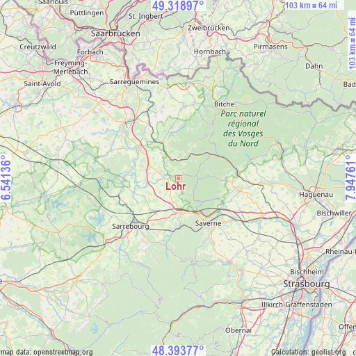
Lohr GPS coordinates[2]
48° 51' 30.636" North, 7° 14' 40.128" East
| Map corner | latitude | longitude |
|---|---|---|
| Upper-left | 49.31897°, | 6.54136° |
| Center: | 48.85851°, | 7.24448° |
| Lower-right: | 48.39377°, | 7.94761° |
| Map W x H: | 102.9×102.9 km | = 63.9×63.9mi |
| max Lat: | 51.07786° ⇑23.2% North |
| Lohr: | 48.85851° |
| min Lat: | ⇓76.8% South 41.3874° |
| min Long | Lohr | max Long |
| -5.08615° | 7.24448° | 9.52242° |
| W 96.1%⇐ | ⇒3.9% E |
Elevation
Elevation of Lohr is 349 m = 1145 ft, and this is 155.3 m = 510 ft above average elevation for this country.
| Max E: |
2333 m = 7654 ft | 14.8% |
| Lohr | 349 m 1145 ft | |
| Avg. | 193.7 m = 635 ft | |
Min E: |
-1 m = -3 ft | 85.2% |
See also: France elevation on elevation.city.
Geographical zone
Lohr is located in North temperate zone (between Tropic of Cancer and the Arctic Circle). Distance of this North polar circle is 1968.6 km =1223.2 mi to North.| Distance of | km | miles | from Lohr |
|---|---|---|---|
| North Pole | 4574.5 | 2842.5 | to North |
| Arctic Circle | 1968.6 | 1223.2 | to North |
| Tropic Cancer | 2826.6 | 1756.4 | to South |
| Equator | 5432.6 | 3375.7 | to South |


Nearby cities:
15 places around Lohr: (largest is in red/bold)
• Danne
11.2 km =7 mi,  160°
160°
• Diemeringen
10 km =6.2 mi,  335°
335°
• Drulingen
4.2 km =2.6 mi,  284°
284°
• Eschbourg
6.2 km =3.9 mi,  142°
142°
• La Petite-Pierre
5.6 km =3.5 mi,  89°
89°
• Mackwiller
9 km =5.6 mi,  325°
325°
• Mittelbronn
9.9 km =6.2 mi,  187°
187°
• Petersbach
2.1 km =1.3 mi,  49°
49°
• Phalsbourg
10.1 km =6.3 mi,  174°
174°
• Rosteig
10.7 km =6.6 mi,  39°
39°
• Saint-Jean-Kourtzerode
11.9 km =7.4 mi,  198°
198°
• Waldhambach
7.9 km =4.9 mi, 344°
• Weislingen
6.9 km =4.3 mi,  5°
5°
• Weyer
6.2 km =3.9 mi,  266°
266°
• Wingen-sur-Moder
11.9 km =7.4 mi,  55°
55°
Sources, notices
• [Note1] Compared only with cities in France existing in our database
• [Src1] Map data: © OpenStreetMap contributors (CC-BY-SA)
• [Src2] Other city data from geonames.org with taken over terms of usage.
• [Src3] Geographical zone / Annual Mean Temperature by Robert A. Rohde @ Wikipedia
