Petersbach geodata
Petersbach (Grand Est) is a populated place; located in France in Europe/Paris (GMT+2) time zone. With population of 688 people, there are 11973 cities with bigger population in this country. Compared to other cities in France, 77% of cities are located further ↓South; 96.2% of cities are located further ←West and 86.7% of cities have lower elevation than Petersbach. Note1
Administrative division(s):
- Level 1: Grand Est
- Level 2: Bas-Rhin
- Level 3: Arrondissement de Saverne
- Level 4: Petersbach


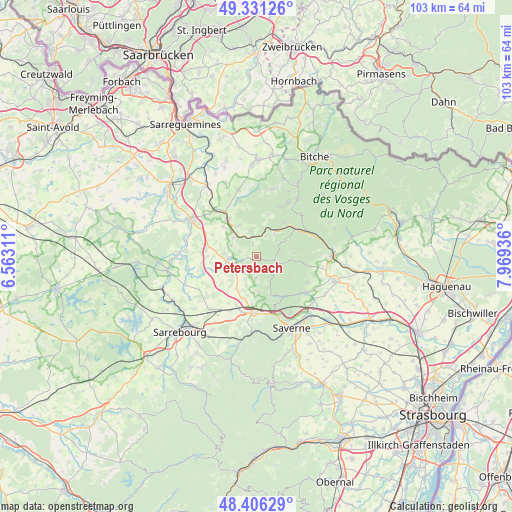
Petersbach GPS coordinates[2]
48° 52' 15.276" North, 7° 15' 58.464" East
| Map corner | latitude | longitude |
|---|---|---|
| Upper-left | 49.33126°, | 6.56311° |
| Center: | 48.87091°, | 7.26624° |
| Lower-right: | 48.40629°, | 7.96936° |
| Map W x H: | 102.8×102.8 km | = 63.9×63.9mi |
| max Lat: | 51.07786° ⇑23% North |
| Petersbach: | 48.87091° |
| min Lat: | ⇓77% South 41.3874° |
| min Long | Petersbach | max Long |
| -5.08615° | 7.26624° | 9.52242° |
| W 96.2%⇐ | ⇒3.8% E |
Elevation
Elevation of Petersbach is 369 m = 1211 ft, and this is 175.3 m = 575 ft above average elevation for this country.
| Max E: |
2333 m = 7654 ft | 13.3% |
| Petersbach | 369 m 1211 ft | |
| Avg. | 193.7 m = 635 ft | |
Min E: |
-1 m = -3 ft | 86.7% |
See also: France elevation on elevation.city.
Geographical zone
Petersbach is located in North temperate zone (between Tropic of Cancer and the Arctic Circle). Distance of this North polar circle is 1967.2 km =1222.4 mi to North.| Distance of | km | miles | from Petersbach |
|---|---|---|---|
| North Pole | 4573.1 | 2841.6 | to North |
| Arctic Circle | 1967.2 | 1222.4 | to North |
| Tropic Cancer | 2828 | 1757.2 | to South |
| Equator | 5433.9 | 3376.5 | to South |


Nearby cities:
15 places around Petersbach: (largest is in red/bold)
• Diemeringen
9.6 km =6 mi,  323°
323°
• Drulingen
5.6 km =3.5 mi,  266°
266°
• Eschbourg
6.7 km =4.2 mi,  161°
161°
• La Petite-Pierre
4.3 km =2.7 mi,  108°
108°
• Lohr
2.1 km =1.3 mi,  229°
229°
• Mackwiller
9 km =5.6 mi,  312°
312°
• Neuwiller-lès-Saverne
11.4 km =7.1 mi,  116°
116°
• Phalsbourg
11.5 km =7.1 mi,  182°
182°
• Rosteig
8.6 km =5.3 mi,  37°
37°
• Soucht
11 km =6.8 mi,  26°
26°
• Waldhambach
7.2 km =4.5 mi,  329°
329°
• Weislingen
5.6 km =3.5 mi,  350°
350°
• Weiterswiller
10.8 km =6.7 mi,  99°
99°
• Weyer
8 km =5 mi,  257°
257°
• Wingen-sur-Moder
9.9 km =6.2 mi,  57°
57°
Sources, notices
• [Note1] Compared only with cities in France existing in our database
• [Src1] Map data: © OpenStreetMap contributors (CC-BY-SA)
• [Src2] Other city data from geonames.org with taken over terms of usage.
• [Src3] Geographical zone / Annual Mean Temperature by Robert A. Rohde @ Wikipedia
