Limas geodata
Limas (Auvergne-Rhône-Alpes) is a populated place; located in France in Europe/Paris (GMT+2) time zone. With population of 4,434 people, there are 2226 cities with bigger population in this country. Compared to other cities in France, 66.5% of cities are located further ↑North; 73.8% of cities are located further ←West and 68.5% of cities have lower elevation than Limas. Note1
Administrative division(s):
- Level 1: Auvergne-Rhône-Alpes
- Level 2: Département du Rhône
- Level 3: Arrondissement de Villefranche-sur-Saône
- Level 4: Limas


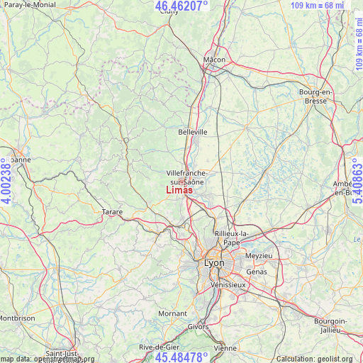
Limas GPS coordinates[2]
45° 58' 32.088" North, 4° 42' 19.8" East
| Map corner | latitude | longitude |
|---|---|---|
| Upper-left | 46.46207°, | 4.00238° |
| Center: | 45.97558°, | 4.7055° |
| Lower-right: | 45.48478°, | 5.40863° |
| Map W x H: | 108.7×108.7 km | = 67.5×67.5mi |
| max Lat: | 51.07786° ⇑66.5% North |
| Limas: | 45.97558° |
| min Lat: | ⇓33.5% South 41.3874° |
| min Long | Limas | max Long |
| -5.08615° | 4.7055° | 9.52242° |
| W 73.8%⇐ | ⇒26.2% E |
Elevation
Elevation of Limas is 211 m = 692 ft, and this is 17.3 m = 57 ft above average elevation for this country.
| Max E: |
2333 m = 7654 ft | 31.5% |
| Limas | 211 m 692 ft | |
| Avg. | 193.7 m = 635 ft | |
Min E: |
-1 m = -3 ft | 68.5% |
See also: France elevation on elevation.city.
Geographical zone
Limas is located in North temperate zone (between Tropic of Cancer and the Arctic Circle). Distance of this North polar circle is 2289.2 km =1422.4 mi to North.| Distance of | km | miles | from Limas |
|---|---|---|---|
| North Pole | 4895.1 | 3041.7 | to North |
| Arctic Circle | 2289.2 | 1422.4 | to North |
| Tropic Cancer | 2506.1 | 1557.2 | to South |
| Equator | 5112 | 3176.4 | to South |


Nearby cities:
15 places around Limas: (largest is in red/bold)
• Anse
4.6 km =2.9 mi,  166°
166°
• Arnas
5.3 km =3.3 mi,  2°
2°
• Beauregard
4.6 km =2.9 mi,  54°
54°
• Denicé
5.5 km =3.4 mi,  301°
301°
• Frans
5.9 km =3.7 mi,  71°
71°
• Gleizé
1.6 km =1 mi,  336°
336°
• Jarnioux
6.2 km =3.9 mi,  258°
258°
• Jassans-Riottier
4.4 km =2.7 mi,  81°
81°
• Lacenas
4.9 km =3 mi,  285°
285°
• Lachassagne
5.8 km =3.6 mi,  193°
193°
• Liergues
3.4 km =2.1 mi, 262°
• Pommiers
2.5 km =1.6 mi,  204°
204°
• Pouilly-le-Monial
5 km =3.1 mi,  245°
245°
• Saint-Didier-de-Formans
6.3 km =3.9 mi,  106°
106°
• Villefranche-sur-Saône
1.9 km =1.2 mi,  34°
34°
Sources, notices
• [Note1] Compared only with cities in France existing in our database
• [Src1] Map data: © OpenStreetMap contributors (CC-BY-SA)
• [Src2] Other city data from geonames.org with taken over terms of usage.
• [Src3] Geographical zone / Annual Mean Temperature by Robert A. Rohde @ Wikipedia
