Lévignac-de-Guyenne geodata
Lévignac-de-Guyenne (Nouvelle-Aquitaine) is a populated place; located in France in Europe/Paris (GMT+2) time zone. With population of 687 people, there are 11986 cities with bigger population in this country. Compared to other cities in France, 82.6% of cities are located further ↑North; 76.3% of cities are located further →East and 60.4% of cities have higher elevation than Lévignac-de-Guyenne. Note1
Administrative division(s):
- Level 1: Nouvelle-Aquitaine
- Level 2: Département du Lot-et-Garonne
- Level 3: Arrondissement de Marmande
- Level 4: Lévignac-de-Guyenne


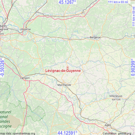
Lévignac-de-Guyenne GPS coordinates[2]
44° 37' 42.456" North, 0° 11' 59.496" East
| Map corner | latitude | longitude |
|---|---|---|
| Upper-left | 45.1267°, | -0.50326° |
| Center: | 44.62846°, | 0.19986° |
| Lower-right: | 44.12591°, | 0.90299° |
| Map W x H: | 111.3×111.3 km | = 69.2×69.2mi |
| max Lat: | 51.07786° ⇑82.6% North |
| Lévignac-de-Guyenne: | 44.62846° |
| min Lat: | ⇓17.4% South 41.3874° |
| min Long | Lévignac-de-Gu | max Long |
| -5.08615° | 0.19986° | 9.52242° |
| W 23.7%⇐ | ⇒76.3% E |
Elevation
Elevation of Lévignac-de-Guyenne is 101 m = 331 ft, and this is 92.7 m = 304 ft below average elevation for this country.
| Max E: |
2333 m = 7654 ft | 60.4% |
| Avg. | 193.7 m = 635 ft | |
| Lévignac-de-Guyenne | 101 m = 331 ft | |
Min E: |
-1 m = -3 ft | 39.6% |
See also: France elevation on elevation.city.
Geographical zone
Lévignac-de-Guyenne is located in North temperate zone (between Tropic of Cancer and the Arctic Circle). Distance of this Northern Tropic circle is 2356.3 km =1464.1 mi to South.| Distance of | km | miles | from Lévignac-de-Guyenne |
|---|---|---|---|
| North Pole | 5044.8 | 3134.7 | to North |
| Arctic Circle | 2439 | 1515.5 | to North |
| Tropic Cancer | 2356.3 | 1464.1 | to South |
| Equator | 4962.2 | 3083.4 | to South |


Nearby cities:
15 places around Lévignac-de-Guyenne: (largest is in red/bold)
• Beaupuy
11.1 km =6.9 mi,  201°
201°
• Castelnau-sur-Gupie
9.3 km =5.8 mi,  214°
214°
• Duras
5.5 km =3.4 mi,  345°
345°
• Escassefort
9.4 km =5.8 mi,  161°
161°
• Lagupie
10.6 km =6.6 mi,  219°
219°
• Marmande
14.5 km =9 mi,  190°
190°
• Miramont-de-Guyenne
13.2 km =8.2 mi,  103°
103°
• Mongauzy
14.9 km =9.3 mi,  242°
242°
• Monségur
9.8 km =6.1 mi,  284°
284°
• Puymiclan
15.9 km =9.9 mi,  144°
144°
• Roumagne
11 km =6.8 mi, 96°
• Saint-Pardoux-Isaac
13.9 km =8.6 mi, 97°
• Sainte-Bazeille
13.6 km =8.5 mi, 216°
• Seyches
12.1 km =7.5 mi, 135°
• Virazeil
13.6 km =8.5 mi,  172°
172°
Sources, notices
• [Note1] Compared only with cities in France existing in our database
• [Src1] Map data: © OpenStreetMap contributors (CC-BY-SA)
• [Src2] Other city data from geonames.org with taken over terms of usage.
• [Src3] Geographical zone / Annual Mean Temperature by Robert A. Rohde @ Wikipedia
