Saint-Pardoux-Isaac geodata
Saint-Pardoux-Isaac (Nouvelle-Aquitaine) is a populated place; located in France in Europe/Paris (GMT+2) time zone. With population of 1,270 people, there are 7183 cities with bigger population in this country. Compared to other cities in France, 82.7% of cities are located further ↑North; 74.5% of cities are located further →East and 67.8% of cities have higher elevation than Saint-Pardoux-Isaac. Note1
Administrative division(s):
- Level 1: Nouvelle-Aquitaine
- Level 2: Département du Lot-et-Garonne
- Level 3: Arrondissement de Marmande
- Level 4: Saint-Pardoux-Isaac


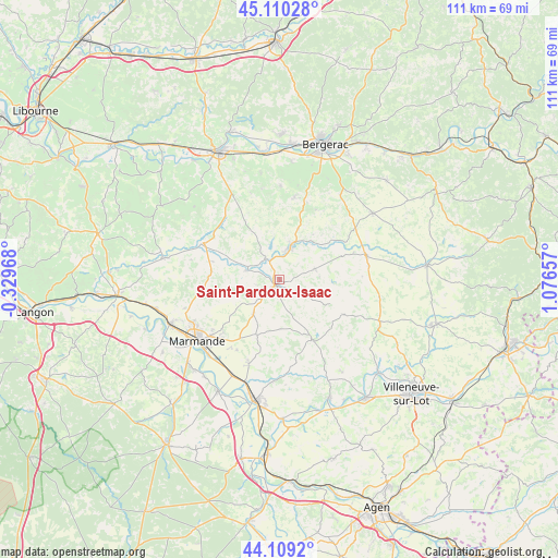
Saint-Pardoux-Isaac GPS coordinates[2]
44° 36' 42.84" North, 0° 22' 24.42" East
| Map corner | latitude | longitude |
|---|---|---|
| Upper-left | 45.11028°, | -0.32968° |
| Center: | 44.6119°, | 0.37345° |
| Lower-right: | 44.1092°, | 1.07657° |
| Map W x H: | 111.3×111.3 km | = 69.2×69.2mi |
| max Lat: | 51.07786° ⇑82.7% North |
| Saint-Pardoux-Isaac: | 44.6119° |
| min Lat: | ⇓17.3% South 41.3874° |
| min Long | Saint-Pardoux-I | max Long |
| -5.08615° | 0.37345° | 9.52242° |
| W 25.5%⇐ | ⇒74.5% E |
Elevation
Elevation of Saint-Pardoux-Isaac is 83 m = 272 ft, and this is 110.7 m = 363 ft below average elevation for this country.
| Max E: |
2333 m = 7654 ft | 67.8% |
| Avg. | 193.7 m = 635 ft | |
| Saint-Pardoux-Isaac | 83 m = 272 ft | |
Min E: |
-1 m = -3 ft | 32.2% |
See also: France elevation on elevation.city.
Geographical zone
Saint-Pardoux-Isaac is located in North temperate zone (between Tropic of Cancer and the Arctic Circle). Distance of this Northern Tropic circle is 2354.5 km =1463 mi to South.| Distance of | km | miles | from Saint-Pardoux-Isaac |
|---|---|---|---|
| North Pole | 5046.7 | 3135.9 | to North |
| Arctic Circle | 2440.8 | 1516.6 | to North |
| Tropic Cancer | 2354.5 | 1463 | to South |
| Equator | 4960.4 | 3082.2 | to South |


Nearby cities:
15 places around Saint-Pardoux-Isaac: (largest is in red/bold)
• Birac-sur-Trec
16.4 km =10.2 mi,  211°
211°
• Duras
16.7 km =10.4 mi,  295°
295°
• Escassefort
12.8 km =8 mi,  236°
236°
• Eymet
6.6 km =4.1 mi,  18°
18°
• Fongrave
9 km =5.6 mi,  166°
166°
• Lauzun
7.2 km =4.5 mi,  74°
74°
• Lavergne
3 km =1.9 mi,  139°
139°
• Lévignac-de-Guyenne
13.9 km =8.6 mi,  277°
277°
• Miramont-de-Guyenne
1.4 km =0.9 mi,  217°
217°
• Monbahus
14.6 km =9.1 mi,  118°
118°
• Puymiclan
12 km =7.5 mi,  202°
202°
• Roumagne
2.8 km =1.7 mi, 283°
• Seyches
8.6 km =5.3 mi, 217°
• Sigoulès
16.6 km =10.3 mi,  10°
10°
• Virazeil
16.7 km =10.4 mi,  225°
225°
Sources, notices
• [Note1] Compared only with cities in France existing in our database
• [Src1] Map data: © OpenStreetMap contributors (CC-BY-SA)
• [Src2] Other city data from geonames.org with taken over terms of usage.
• [Src3] Geographical zone / Annual Mean Temperature by Robert A. Rohde @ Wikipedia
