Leignes-sur-Fontaine geodata
Leignes-sur-Fontaine (Nouvelle-Aquitaine) is a populated place; located in France in Europe/Paris (GMT+2) time zone. With population of 532 people, there are 14567 cities with bigger population in this country. Compared to other cities in France, 60.1% of cities are located further ↑North; 70.7% of cities are located further →East and 54.5% of cities have lower elevation than Leignes-sur-Fontaine. Note1
Administrative division(s):
- Level 1: Nouvelle-Aquitaine
- Level 2: Vienne
- Level 3: Arrondissement de Montmorillon
- Level 4: Leignes-sur-Fontaine


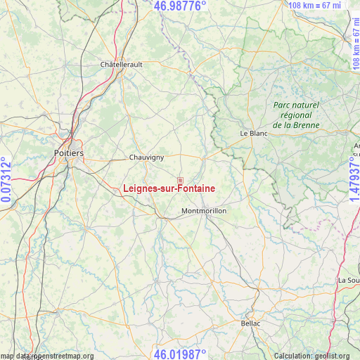
Leignes-sur-Fontaine GPS coordinates[2]
46° 30' 21.492" North, 0° 46' 34.5" East
| Map corner | latitude | longitude |
|---|---|---|
| Upper-left | 46.98776°, | 0.07312° |
| Center: | 46.50597°, | 0.77625° |
| Lower-right: | 46.01987°, | 1.47937° |
| Map W x H: | 107.6×107.6 km | = 66.9×66.9mi |
| max Lat: | 51.07786° ⇑60.1% North |
| Leignes-sur-Fontaine: | 46.50597° |
| min Lat: | ⇓39.9% South 41.3874° |
| min Long | Leignes-sur-Fon | max Long |
| -5.08615° | 0.77625° | 9.52242° |
| W 29.3%⇐ | ⇒70.7% E |
Elevation
Elevation of Leignes-sur-Fontaine is 148 m = 486 ft, and this is 45.7 m = 150 ft below average elevation for this country.
| Max E: |
2333 m = 7654 ft | 45.5% |
| Avg. | 193.7 m = 635 ft | |
| Leignes-sur-Fontaine | 148 m = 486 ft | |
Min E: |
-1 m = -3 ft | 54.5% |
See also: France elevation on elevation.city.
Geographical zone
Leignes-sur-Fontaine is located in North temperate zone (between Tropic of Cancer and the Arctic Circle). Distance of this North polar circle is 2230.2 km =1385.8 mi to North.| Distance of | km | miles | from Leignes-sur-Fontaine |
|---|---|---|---|
| North Pole | 4836.1 | 3005 | to North |
| Arctic Circle | 2230.2 | 1385.8 | to North |
| Tropic Cancer | 2565.1 | 1593.9 | to South |
| Equator | 5171 | 3213.1 | to South |


Nearby cities:
15 places around Leignes-sur-Fontaine: (largest is in red/bold)
• Antigny
6.7 km =4.2 mi,  61°
61°
• Béthines
15.9 km =9.9 mi,  73°
73°
• Chauvigny
12.4 km =7.7 mi,  304°
304°
• Civaux
10.9 km =6.8 mi,  230°
230°
• La Puye
15.3 km =9.5 mi,  352°
352°
• Lhommaizé
15.8 km =9.8 mi,  240°
240°
• Lussac-les-Châteaux
12.1 km =7.5 mi,  199°
199°
• Mazerolles
13.3 km =8.3 mi,  212°
212°
• Montmorillon
11.4 km =7.1 mi,  141°
141°
• Pouillé
15.6 km =9.7 mi,  282°
282°
• Saint-Germain
9.8 km =6.1 mi,  49°
49°
• Saint-Savin
9.5 km =5.9 mi, 45°
• Saulgé
16.2 km =10.1 mi,  151°
151°
• Sillars
9.6 km =6 mi,  183°
183°
• Tercé
16.3 km =10.1 mi,  274°
274°
Sources, notices
• [Note1] Compared only with cities in France existing in our database
• [Src1] Map data: © OpenStreetMap contributors (CC-BY-SA)
• [Src2] Other city data from geonames.org with taken over terms of usage.
• [Src3] Geographical zone / Annual Mean Temperature by Robert A. Rohde @ Wikipedia
