Antigny geodata
Antigny (Nouvelle-Aquitaine) is a populated place; located in France in Europe/Paris (GMT+2) time zone. With population of 638 people, there are 12704 cities with bigger population in this country. Compared to other cities in France, 59.8% of cities are located further ↑North; 70.1% of cities are located further →East and 55.6% of cities have higher elevation than Antigny. Note1
Administrative division(s):
- Level 1: Nouvelle-Aquitaine
- Level 2: Vienne
- Level 3: Arrondissement de Montmorillon
- Level 4: Antigny


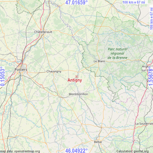
Antigny GPS coordinates[2]
46° 32' 6.216" North, 0° 51' 13.176" East
| Map corner | latitude | longitude |
|---|---|---|
| Upper-left | 47.01659°, | 0.15053° |
| Center: | 46.53506°, | 0.85366° |
| Lower-right: | 46.04922°, | 1.55678° |
| Map W x H: | 107.6×107.6 km | = 66.9×66.9mi |
| max Lat: | 51.07786° ⇑59.8% North |
| Antigny: | 46.53506° |
| min Lat: | ⇓40.2% South 41.3874° |
| min Long | Antigny | max Long |
| -5.08615° | 0.85366° | 9.52242° |
| W 29.9%⇐ | ⇒70.1% E |
Elevation
Elevation of Antigny is 115 m = 377 ft, and this is 78.7 m = 258 ft below average elevation for this country.
| Max E: |
2333 m = 7654 ft | 55.6% |
| Avg. | 193.7 m = 635 ft | |
| Antigny | 115 m = 377 ft | |
Min E: |
-1 m = -3 ft | 44.4% |
See also: France elevation on elevation.city.
Geographical zone
Antigny is located in North temperate zone (between Tropic of Cancer and the Arctic Circle). Distance of this North polar circle is 2227 km =1383.8 mi to North.| Distance of | km | miles | from Antigny |
|---|---|---|---|
| North Pole | 4832.8 | 3003 | to North |
| Arctic Circle | 2227 | 1383.8 | to North |
| Tropic Cancer | 2568.3 | 1595.9 | to South |
| Equator | 5174.2 | 3215.1 | to South |


Nearby cities:
15 places around Antigny: (largest is in red/bold)
• Béthines
9.4 km =5.8 mi,  81°
81°
• Chauvigny
16.5 km =10.3 mi,  283°
283°
• Civaux
17.6 km =10.9 mi,  234°
234°
• Concremiers
14.2 km =8.8 mi,  61°
61°
• La Puye
14.3 km =8.9 mi,  326°
326°
• La Trimouille
16.1 km =10 mi,  117°
117°
• Leignes-sur-Fontaine
6.7 km =4.2 mi,  241°
241°
• Lussac-les-Châteaux
17.7 km =11 mi,  214°
214°
• Montmorillon
12.1 km =7.5 mi,  174°
174°
• Mérigny
12 km =7.5 mi,  27°
27°
• Saint-Germain
3.5 km =2.2 mi, 25°
• Saint-Pierre-de-Maillé
16 km =9.9 mi,  357°
357°
• Saint-Savin
3.5 km =2.2 mi,  12°
12°
• Saulgé
17.6 km =10.9 mi, 174°
• Sillars
14.4 km =8.9 mi, 206°
Sources, notices
• [Note1] Compared only with cities in France existing in our database
• [Src1] Map data: © OpenStreetMap contributors (CC-BY-SA)
• [Src2] Other city data from geonames.org with taken over terms of usage.
• [Src3] Geographical zone / Annual Mean Temperature by Robert A. Rohde @ Wikipedia
