Léaz geodata
Léaz (Auvergne-Rhône-Alpes) is a populated place; located in France in Europe/Paris (GMT+2) time zone. With population of 508 people, there are 15076 cities with bigger population in this country. Compared to other cities in France, 65.1% of cities are located further ↑North; 85.8% of cities are located further ←West and 90.9% of cities have lower elevation than Léaz. Note1
Administrative division(s):
- Level 1: Auvergne-Rhône-Alpes
- Level 2: Département de l'Ain
- Level 3: Arrondissement de Gex
- Level 4: Léaz


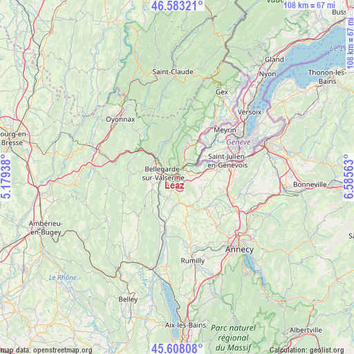
Léaz GPS coordinates[2]
46° 5' 52.08" North, 5° 52' 57" East
| Map corner | latitude | longitude |
|---|---|---|
| Upper-left | 46.58321°, | 5.17938° |
| Center: | 46.0978°, | 5.8825° |
| Lower-right: | 45.60808°, | 6.58563° |
| Map W x H: | 108.4×108.4 km | = 67.4×67.4mi |
| max Lat: | 51.07786° ⇑65.1% North |
| Léaz: | 46.0978° |
| min Lat: | ⇓34.9% South 41.3874° |
| min Long | Léaz | max Long |
| -5.08615° | 5.8825° | 9.52242° |
| W 85.8%⇐ | ⇒14.2% E |
Elevation
Elevation of Léaz is 446 m = 1463 ft, and this is 252.3 m = 828 ft above average elevation for this country.
| Max E: |
2333 m = 7654 ft | 9.1% |
| Léaz | 446 m 1463 ft | |
| Avg. | 193.7 m = 635 ft | |
Min E: |
-1 m = -3 ft | 90.9% |
See also: France elevation on elevation.city.
Geographical zone
Léaz is located in North temperate zone (between Tropic of Cancer and the Arctic Circle). Distance of this North polar circle is 2275.6 km =1414 mi to North.| Distance of | km | miles | from Léaz |
|---|---|---|---|
| North Pole | 4881.5 | 3033.2 | to North |
| Arctic Circle | 2275.6 | 1414 | to North |
| Tropic Cancer | 2519.7 | 1565.7 | to South |
| Equator | 5125.6 | 3184.9 | to South |


Nearby cities:
15 places around Léaz: (largest is in red/bold)
• Bellegarde-sur-Valserine
4.6 km =2.9 mi,  283°
283°
• Châtillon-en-Michaille
8.1 km =5 mi,  308°
308°
• Collonges
4.8 km =3 mi,  21°
21°
• Confort
7.4 km =4.6 mi,  322°
322°
• Farges
7.9 km =4.9 mi,  12°
12°
• Frangy
9.5 km =5.9 mi,  156°
156°
• Génissiat
8 km =5 mi,  230°
230°
• Jonzier
8.9 km =5.5 mi,  109°
109°
• Lancrans
5 km =3.1 mi, 310°
• Minzier
9.7 km =6 mi,  122°
122°
• Pougny
7 km =4.3 mi,  47°
47°
• Savigny
6.4 km =4 mi, 121°
• Valleiry
6.9 km =4.3 mi,  77°
77°
• Vulbens
4 km =2.5 mi, 84°
• Éloise
2.6 km =1.6 mi,  220°
220°
Sources, notices
• [Note1] Compared only with cities in France existing in our database
• [Src1] Map data: © OpenStreetMap contributors (CC-BY-SA)
• [Src2] Other city data from geonames.org with taken over terms of usage.
• [Src3] Geographical zone / Annual Mean Temperature by Robert A. Rohde @ Wikipedia
