Génissiat geodata
Génissiat (Auvergne-Rhône-Alpes) is a populated place; located in France in Europe/Paris (GMT+2) time zone. With population of 929 people, there are 9398 cities with bigger population in this country. Compared to other cities in France, 65.7% of cities are located further ↑North; 85.2% of cities are located further ←West and 85.5% of cities have lower elevation than Génissiat. Note1
Administrative division(s):
- Level 1: Auvergne-Rhône-Alpes
- Level 2: Département de l'Ain
- Level 3: Arrondissement de Nantua
- Level 4: Injoux-Génissiat


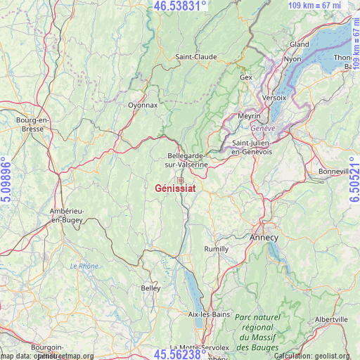
Génissiat GPS coordinates[2]
46° 3' 9" North, 5° 48' 7.524" East
| Map corner | latitude | longitude |
|---|---|---|
| Upper-left | 46.53831°, | 5.09896° |
| Center: | 46.0525°, | 5.80209° |
| Lower-right: | 45.56238°, | 6.50521° |
| Map W x H: | 108.5×108.5 km | = 67.4×67.4mi |
| max Lat: | 51.07786° ⇑65.7% North |
| Génissiat: | 46.0525° |
| min Lat: | ⇓34.3% South 41.3874° |
| min Long | Génissiat | max Long |
| -5.08615° | 5.80209° | 9.52242° |
| W 85.2%⇐ | ⇒14.8% E |
Elevation
Elevation of Génissiat is 353 m = 1158 ft, and this is 159.3 m = 523 ft above average elevation for this country.
| Max E: |
2333 m = 7654 ft | 14.5% |
| Génissiat | 353 m 1158 ft | |
| Avg. | 193.7 m = 635 ft | |
Min E: |
-1 m = -3 ft | 85.5% |
See also: France elevation on elevation.city.
Geographical zone
Génissiat is located in North temperate zone (between Tropic of Cancer and the Arctic Circle). Distance of this North polar circle is 2280.6 km =1417.1 mi to North.| Distance of | km | miles | from Génissiat |
|---|---|---|---|
| North Pole | 4886.5 | 3036.3 | to North |
| Arctic Circle | 2280.6 | 1417.1 | to North |
| Tropic Cancer | 2514.6 | 1562.5 | to South |
| Equator | 5120.6 | 3181.8 | to South |


Nearby cities:
15 places around Génissiat: (largest is in red/bold)
• Bellegarde-sur-Valserine
6.4 km =4 mi,  15°
15°
• Chanay
5.4 km =3.4 mi,  194°
194°
• Châtillon-en-Michaille
10.1 km =6.3 mi,  358°
358°
• Collonges
12.4 km =7.7 mi,  39°
39°
• Confort
11 km =6.8 mi,  8°
8°
• Corbonod
9.6 km =6 mi,  170°
170°
• Desingy
9.2 km =5.7 mi,  133°
133°
• Frangy
10.7 km =6.6 mi,  109°
109°
• Lancrans
8.6 km =5.3 mi, 15°
• Léaz
8 km =5 mi,  50°
50°
• Savigny
11.8 km =7.3 mi,  81°
81°
• Seyssel
10.6 km =6.6 mi, 167°
• Seyssel
10.7 km =6.6 mi, 165°
• Vulbens
11.6 km =7.2 mi,  61°
61°
• Éloise
5.5 km =3.4 mi, 55°
Sources, notices
• [Note1] Compared only with cities in France existing in our database
• [Src1] Map data: © OpenStreetMap contributors (CC-BY-SA)
• [Src2] Other city data from geonames.org with taken over terms of usage.
• [Src3] Geographical zone / Annual Mean Temperature by Robert A. Rohde @ Wikipedia
