Laval-sur-Vologne geodata
Laval-sur-Vologne (Grand Est) is a populated place; located in France in Europe/Paris (GMT+2) time zone. With population of 623 people, there are 12932 cities with bigger population in this country. Compared to other cities in France, 62.7% of cities are located further ↓South; 93.1% of cities are located further ←West and 89.6% of cities have lower elevation than Laval-sur-Vologne. Note1
Administrative division(s):
- Level 1: Grand Est
- Level 2: Vosges
- Level 3: Arrondissement d’Épinal
- Level 4: Laval-sur-Vologne


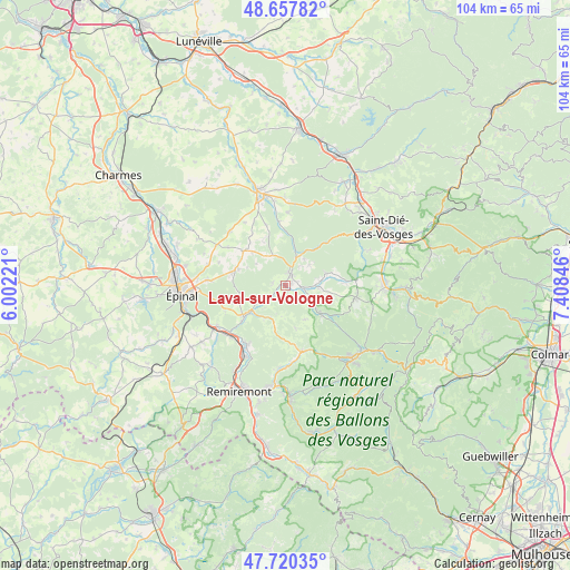
Laval-sur-Vologne GPS coordinates[2]
48° 11' 28.428" North, 6° 42' 19.188" East
| Map corner | latitude | longitude |
|---|---|---|
| Upper-left | 48.65782°, | 6.00221° |
| Center: | 48.19123°, | 6.70533° |
| Lower-right: | 47.72035°, | 7.40846° |
| Map W x H: | 104.2×104.2 km | = 64.7×64.7mi |
| max Lat: | 51.07786° ⇑37.3% North |
| Laval-sur-Vologne: | 48.19123° |
| min Lat: | ⇓62.7% South 41.3874° |
| min Long | Laval-sur-Volog | max Long |
| -5.08615° | 6.70533° | 9.52242° |
| W 93.1%⇐ | ⇒6.9% E |
Elevation
Elevation of Laval-sur-Vologne is 417 m = 1368 ft, and this is 223.3 m = 733 ft above average elevation for this country.
| Max E: |
2333 m = 7654 ft | 10.4% |
| Laval-sur-Vologne | 417 m 1368 ft | |
| Avg. | 193.7 m = 635 ft | |
Min E: |
-1 m = -3 ft | 89.6% |
See also: France elevation on elevation.city.
Geographical zone
Laval-sur-Vologne is located in North temperate zone (between Tropic of Cancer and the Arctic Circle). Distance of this North polar circle is 2042.8 km =1269.3 mi to North.| Distance of | km | miles | from Laval-sur-Vologne |
|---|---|---|---|
| North Pole | 4648.7 | 2888.6 | to North |
| Arctic Circle | 2042.8 | 1269.3 | to North |
| Tropic Cancer | 2752.4 | 1710.3 | to South |
| Equator | 5358.4 | 3329.6 | to South |


Nearby cities:
15 places around Laval-sur-Vologne: (largest is in red/bold)
• Aydoilles
10 km =6.2 mi,  282°
282°
• Brouvelieures
5.4 km =3.4 mi,  20°
20°
• Bruyères
2 km =1.2 mi,  28°
28°
• Champ-le-Duc
1.3 km =0.8 mi,  66°
66°
• Cheniménil
9.5 km =5.9 mi,  232°
232°
• Corcieux
13.2 km =8.2 mi,  99°
99°
• Docelles
8.6 km =5.3 mi, 232°
• Grandvillers
6.5 km =4 mi,  324°
324°
• Granges-sur-Vologne
8.2 km =5.1 mi,  128°
128°
• La Baffe
10.2 km =6.3 mi,  251°
251°
• La Houssière
10.9 km =6.8 mi,  87°
87°
• Laveline-devant-Bruyères
3.9 km =2.4 mi, 93°
• Le Tholy
12.4 km =7.7 mi,  166°
166°
• Lépanges-sur-Vologne
4 km =2.5 mi, 226°
• Éloyes
12.7 km =7.9 mi,  215°
215°
Sources, notices
• [Note1] Compared only with cities in France existing in our database
• [Src1] Map data: © OpenStreetMap contributors (CC-BY-SA)
• [Src2] Other city data from geonames.org with taken over terms of usage.
• [Src3] Geographical zone / Annual Mean Temperature by Robert A. Rohde @ Wikipedia
