Lathus-Saint-Rémy geodata
Lathus-Saint-Rémy (Nouvelle-Aquitaine) is a populated place; located in France in Europe/Paris (GMT+2) time zone. With population of 1,358 people, there are 6774 cities with bigger population in this country. Compared to other cities in France, 61.9% of cities are located further ↑North; 69.2% of cities are located further →East and 61.3% of cities have lower elevation than Lathus-Saint-Rémy. Note1
Administrative division(s):
- Level 1: Nouvelle-Aquitaine
- Level 2: Vienne
- Level 3: Arrondissement de Montmorillon
- Level 4: Lathus-Saint-Rémy


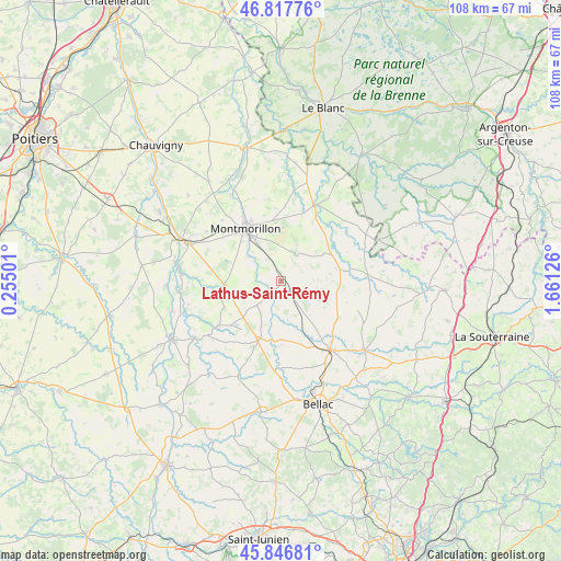
Lathus-Saint-Rémy GPS coordinates[2]
46° 20' 3.984" North, 0° 57' 29.268" East
| Map corner | latitude | longitude |
|---|---|---|
| Upper-left | 46.81776°, | 0.25501° |
| Center: | 46.33444°, | 0.95813° |
| Lower-right: | 45.84681°, | 1.66126° |
| Map W x H: | 108×108 km | = 67.1×67.1mi |
| max Lat: | 51.07786° ⇑61.9% North |
| Lathus-Saint-Rémy: | 46.33444° |
| min Lat: | ⇓38.1% South 41.3874° |
| min Long | Lathus-Saint-R� | max Long |
| -5.08615° | 0.95813° | 9.52242° |
| W 30.8%⇐ | ⇒69.2% E |
Elevation
Elevation of Lathus-Saint-Rémy is 176 m = 577 ft, and this is 17.7 m = 58 ft below average elevation for this country.
| Max E: |
2333 m = 7654 ft | 38.7% |
| Avg. | 193.7 m = 635 ft | |
| Lathus-Saint-Rémy | 176 m = 577 ft | |
Min E: |
-1 m = -3 ft | 61.3% |
See also: France elevation on elevation.city.
Geographical zone
Lathus-Saint-Rémy is located in North temperate zone (between Tropic of Cancer and the Arctic Circle). Distance of this North polar circle is 2249.3 km =1397.6 mi to North.| Distance of | km | miles | from Lathus-Saint-Rémy |
|---|---|---|---|
| North Pole | 4855.2 | 3016.9 | to North |
| Arctic Circle | 2249.3 | 1397.6 | to North |
| Tropic Cancer | 2546 | 1582 | to South |
| Equator | 5151.9 | 3201.2 | to South |


Nearby cities:
15 places around Lathus-Saint-Rémy: (largest is in red/bold)
• Adriers
14.9 km =9.3 mi,  234°
234°
• Brigueil-le-Chantre
12 km =7.5 mi,  55°
55°
• Bussière-Poitevine
11.8 km =7.3 mi,  200°
200°
• Gouex
20.8 km =12.9 mi,  279°
279°
• La Trimouille
16.1 km =10 mi,  23°
23°
• Le Dorat
16.4 km =10.2 mi,  144°
144°
• Lussac-les-Châteaux
19.6 km =12.2 mi,  293°
293°
• Lussac-les-Églises
16.6 km =10.3 mi,  85°
85°
• Magnac-Laval
20.8 km =12.9 mi,  129°
129°
• Montmorillon
12.3 km =7.6 mi,  326°
326°
• Moussac
21.6 km =13.4 mi,  253°
253°
• Persac
19.4 km =12.1 mi,  273°
273°
• Saint-Bonnet-de-Bellac
18.4 km =11.4 mi,  180°
180°
• Saulgé
7.9 km =4.9 mi,  307°
307°
• Sillars
17.4 km =10.8 mi,  303°
303°
Sources, notices
• [Note1] Compared only with cities in France existing in our database
• [Src1] Map data: © OpenStreetMap contributors (CC-BY-SA)
• [Src2] Other city data from geonames.org with taken over terms of usage.
• [Src3] Geographical zone / Annual Mean Temperature by Robert A. Rohde @ Wikipedia
