Saint-André-de-Majencoules geodata
Saint-André-de-Majencoules (Occitanie) is a populated place; located in France in Europe/Paris (GMT+2) time zone. With population of 602 people, there are 13285 cities with bigger population in this country. Compared to other cities in France, 86.9% of cities are located further ↑North; 65.6% of cities are located further ←West and 84.4% of cities have lower elevation than Saint-André-de-Majencoules. Note1
Administrative division(s):
- Level 1: Occitanie
- Level 2: Gard
- Level 3: Arrondissement du Vigan
- Level 4: Saint-André-de-Majencoules
Current local time in Saint-André-de-Majencoules:
03:04 AM, WednesdayDifference from your time zone: hours


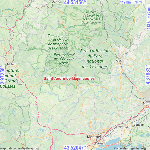
Saint-André-de-Majencoules GPS coordinates[2]
44° 1' 41.412" North, 3° 40' 32.52" East
| Map corner | latitude | longitude |
|---|---|---|
| Upper-left | 44.53156°, | 2.97258° |
| Center: | 44.02817°, | 3.6757° |
| Lower-right: | 43.52047°, | 4.37883° |
| Map W x H: | 112.4×112.4 km | = 69.8×69.8mi |
| max Lat: | 51.07786° ⇑86.9% North |
| Saint-André-de-Majencoules: | 44.02817° |
| min Lat: | ⇓13.1% South 41.3874° |
| min Long | Saint-André-de | max Long |
| -5.08615° | 3.6757° | 9.52242° |
| W 65.6%⇐ | ⇒34.4% E |
Elevation
Elevation of Saint-André-de-Majencoules is 340 m = 1115 ft, and this is 146.3 m = 480 ft above average elevation for this country.
| Max E: |
2333 m = 7654 ft | 15.6% |
| Saint-André-de-Majencoules | 340 m 1115 ft | |
| Avg. | 193.7 m = 635 ft | |
Min E: |
-1 m = -3 ft | 84.4% |
See also: France elevation on elevation.city.
Geographical zone
Saint-André-de-Majencoules is located in North temperate zone (between Tropic of Cancer and the Arctic Circle). Distance of this Northern Tropic circle is 2289.6 km =1422.7 mi to South.| Distance of | km | miles | from Saint-André-de-Majencoules |
|---|---|---|---|
| North Pole | 5111.6 | 3176.2 | to North |
| Arctic Circle | 2505.7 | 1557 | to North |
| Tropic Cancer | 2289.6 | 1422.7 | to South |
| Equator | 4895.5 | 3041.9 | to South |


Nearby cities:
15 places around Saint-André-de-Majencoules: (largest is in red/bold)
• Avèze
8.7 km =5.4 mi,  223°
223°
• Brissac
16.8 km =10.4 mi,  172°
172°
• Cazilhac
12.2 km =7.6 mi, 169°
• Ganges
10.8 km =6.7 mi, 166°
• Laroque
12.3 km =7.6 mi,  161°
161°
• Lasalle
14.4 km =8.9 mi,  82°
82°
• Le Vigan
6.9 km =4.3 mi,  234°
234°
• Molières-Cavaillac
9.9 km =6.2 mi, 233°
• Monoblet
17.2 km =10.7 mi,  100°
100°
• Saint-Bauzille-de-Putois
15.6 km =9.7 mi, 162°
• Saint-Hippolyte-du-Fort
16.1 km =10 mi,  116°
116°
• Saint-Jean-du-Gard
18.8 km =11.7 mi,  62°
62°
• Saint-Étienne-Vallée-Française
20.3 km =12.6 mi,  40°
40°
• Sumène
6.2 km =3.9 mi,  148°
148°
• Valleraugue
6.5 km =4 mi,  335°
335°
Sources, notices
• [Note1] Compared only with cities in France existing in our database
• [Src1] Map data: © OpenStreetMap contributors (CC-BY-SA)
• [Src2] Other city data from geonames.org with taken over terms of usage.
• [Src3] Geographical zone / Annual Mean Temperature by Robert A. Rohde @ Wikipedia
