Belligné geodata
Belligné (Pays de la Loire) is a populated place; located in France in Europe/Paris (GMT+2) time zone. With population of 1,690 people, there are 5545 cities with bigger population in this country. Compared to other cities in France, 50.7% of cities are located further ↓South; 88.4% of cities are located further →East and 77.8% of cities have higher elevation than Belligné. Note1
Administrative division(s):
- Level 1: Pays de la Loire
- Level 2: Loire-Atlantique
- Level 3: Arrondissement of Châteaubriant-Ancenis
- Level 4: Loireauxence


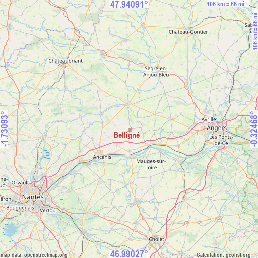
Belligné GPS coordinates[2]
47° 28' 3.864" North, 1° 1' 40.08" West
| Map corner | latitude | longitude |
|---|---|---|
| Upper-left | 47.94091°, | -1.73093° |
| Center: | 47.46774°, | -1.0278° |
| Lower-right: | 46.99027°, | -0.32468° |
| Map W x H: | 105.7×105.7 km | = 65.7×65.7mi |
| max Lat: | 51.07786° ⇑49.3% North |
| Belligné: | 47.46774° |
| min Lat: | ⇓50.7% South 41.3874° |
| min Long | Belligné | max Long |
| -5.08615° | -1.0278° | 9.52242° |
| W 11.6%⇐ | ⇒88.4% E |
Elevation
Elevation of Belligné is 60 m = 197 ft, and this is 133.7 m = 439 ft below average elevation for this country.
| Max E: |
2333 m = 7654 ft | 77.8% |
| Avg. | 193.7 m = 635 ft | |
| Belligné | 60 m = 197 ft | |
Min E: |
-1 m = -3 ft | 22.2% |
See also: France elevation on elevation.city.
Geographical zone
Belligné is located in North temperate zone (between Tropic of Cancer and the Arctic Circle). Distance of this North polar circle is 2123.3 km =1319.4 mi to North.| Distance of | km | miles | from Belligné |
|---|---|---|---|
| North Pole | 4729.1 | 2938.5 | to North |
| Arctic Circle | 2123.3 | 1319.4 | to North |
| Tropic Cancer | 2672 | 1660.3 | to South |
| Equator | 5277.9 | 3279.5 | to South |


Nearby cities:
15 places around Belligné: (largest is in red/bold)
• Anetz
11.3 km =7 mi,  211°
211°
• Candé
10.5 km =6.5 mi,  356°
356°
• Freigné
11.5 km =7.1 mi,  321°
321°
• Ingrandes
10.5 km =6.5 mi,  131°
131°
• La Chapelle-Saint-Sauveur
4.4 km =2.7 mi, 132°
• La Cornuaille
5.8 km =3.6 mi,  34°
34°
• La Roche-Blanche
9 km =5.6 mi,  250°
250°
• La Rouxière
4.1 km =2.5 mi,  226°
226°
• Le Fresne-sur-Loire
10.5 km =6.5 mi, 134°
• Maumusson
6.1 km =3.8 mi,  285°
285°
• Pouillé-les-Côteaux
10.2 km =6.3 mi,  262°
262°
• Saint-Florent-le-Vieil
11.9 km =7.4 mi,  175°
175°
• Saint-Herblon
8.5 km =5.3 mi,  218°
218°
• Varades
9.2 km =5.7 mi, 180°
• Villemoisan
10.2 km =6.3 mi,  92°
92°
Sources, notices
• [Note1] Compared only with cities in France existing in our database
• [Src1] Map data: © OpenStreetMap contributors (CC-BY-SA)
• [Src2] Other city data from geonames.org with taken over terms of usage.
• [Src3] Geographical zone / Annual Mean Temperature by Robert A. Rohde @ Wikipedia
