Varades geodata
Varades (Pays de la Loire) is a populated place; located in France in Europe/Paris (GMT+2) time zone. With population of 3,452 people, there are 2814 cities with bigger population in this country. Compared to other cities in France, 50.3% of cities are located further ↑North; 88.4% of cities are located further →East and 90.3% of cities have higher elevation than Varades. Note1
Administrative division(s):
- Level 1: Pays de la Loire
- Level 2: Loire-Atlantique
- Level 3: Arrondissement of Châteaubriant-Ancenis
- Level 4: Loireauxence


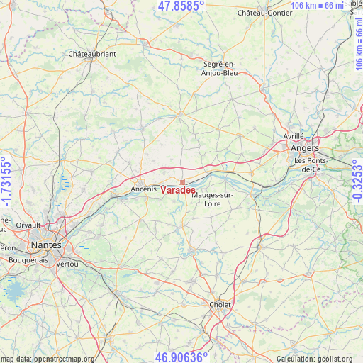
Varades GPS coordinates[2]
47° 23' 4.488" North, 1° 1' 42.312" West
| Map corner | latitude | longitude |
|---|---|---|
| Upper-left | 47.8585°, | -1.73155° |
| Center: | 47.38458°, | -1.02842° |
| Lower-right: | 46.90636°, | -0.3253° |
| Map W x H: | 105.9×105.9 km | = 65.8×65.8mi |
| max Lat: | 51.07786° ⇑50.3% North |
| Varades: | 47.38458° |
| min Lat: | ⇓49.7% South 41.3874° |
| min Long | Varades | max Long |
| -5.08615° | -1.02842° | 9.52242° |
| W 11.6%⇐ | ⇒88.4% E |
Elevation
Elevation of Varades is 29 m = 95 ft, and this is 164.7 m = 540 ft below average elevation for this country.
| Max E: |
2333 m = 7654 ft | 90.3% |
| Avg. | 193.7 m = 635 ft | |
| Varades | 29 m = 95 ft | |
Min E: |
-1 m = -3 ft | 9.7% |
See also: France elevation on elevation.city.
Geographical zone
Varades is located in North temperate zone (between Tropic of Cancer and the Arctic Circle). Distance of this North polar circle is 2132.5 km =1325.1 mi to North.| Distance of | km | miles | from Varades |
|---|---|---|---|
| North Pole | 4738.4 | 2944.3 | to North |
| Arctic Circle | 2132.5 | 1325.1 | to North |
| Tropic Cancer | 2662.8 | 1654.6 | to South |
| Equator | 5268.7 | 3273.8 | to South |


Nearby cities:
15 places around Varades: (largest is in red/bold)
• Anetz
5.8 km =3.6 mi,  265°
265°
• Belligné
9.2 km =5.7 mi,  0°
0°
• Botz-en-Mauges
8.9 km =5.5 mi,  166°
166°
• Bouzillé
8.2 km =5.1 mi,  230°
230°
• Ingrandes
8.2 km =5.1 mi,  73°
73°
• La Chapelle-Saint-Florent
6 km =3.7 mi,  200°
200°
• La Chapelle-Saint-Sauveur
7.1 km =4.4 mi,  27°
27°
• La Roche-Blanche
10.4 km =6.5 mi,  306°
306°
• La Rouxière
7 km =4.3 mi,  335°
335°
• Le Fresne-sur-Loire
7.7 km =4.8 mi,  76°
76°
• Le Marillais
4.7 km =2.9 mi, 230°
• Le Mesnil-en-Vallée
7.4 km =4.6 mi,  106°
106°
• Saint-Florent-le-Vieil
2.8 km =1.7 mi,  159°
159°
• Saint-Herblon
5.8 km =3.6 mi,  296°
296°
• Saint-Laurent-du-Mottay
7 km =4.3 mi,  122°
122°
Sources, notices
• [Note1] Compared only with cities in France existing in our database
• [Src1] Map data: © OpenStreetMap contributors (CC-BY-SA)
• [Src2] Other city data from geonames.org with taken over terms of usage.
• [Src3] Geographical zone / Annual Mean Temperature by Robert A. Rohde @ Wikipedia
