Laning geodata
Laning (Grand Est) is a populated place; located in France in Europe/Paris (GMT+2) time zone. With population of 609 people, there are 13174 cities with bigger population in this country. Compared to other cities in France, 80.5% of cities are located further ↓South; 93.5% of cities are located further ←West and 80.4% of cities have lower elevation than Laning. Note1
Administrative division(s):
- Level 1: Grand Est
- Level 2: Moselle
- Level 3: Arrondissement de Forbach-Boulay-Moselle
- Level 4: Laning


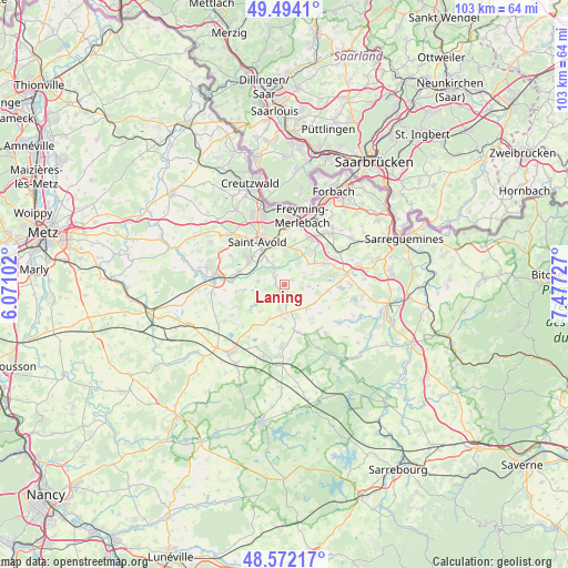
Laning GPS coordinates[2]
49° 2' 6.972" North, 6° 46' 26.94" East
| Map corner | latitude | longitude |
|---|---|---|
| Upper-left | 49.4941°, | 6.07102° |
| Center: | 49.03527°, | 6.77415° |
| Lower-right: | 48.57217°, | 7.47727° |
| Map W x H: | 102.5×102.5 km | = 63.7×63.7mi |
| max Lat: | 51.07786° ⇑19.5% North |
| Laning: | 49.03527° |
| min Lat: | ⇓80.5% South 41.3874° |
| min Long | Laning | max Long |
| -5.08615° | 6.77415° | 9.52242° |
| W 93.5%⇐ | ⇒6.5% E |
Elevation
Elevation of Laning is 295 m = 968 ft, and this is 101.3 m = 332 ft above average elevation for this country.
| Max E: |
2333 m = 7654 ft | 19.6% |
| Laning | 295 m 968 ft | |
| Avg. | 193.7 m = 635 ft | |
Min E: |
-1 m = -3 ft | 80.4% |
See also: France elevation on elevation.city.
Geographical zone
Laning is located in North temperate zone (between Tropic of Cancer and the Arctic Circle). Distance of this North polar circle is 1949 km =1211.1 mi to North.| Distance of | km | miles | from Laning |
|---|---|---|---|
| North Pole | 4554.9 | 2830.3 | to North |
| Arctic Circle | 1949 | 1211.1 | to North |
| Tropic Cancer | 2846.3 | 1768.6 | to South |
| Equator | 5452.2 | 3387.8 | to South |


Nearby cities:
15 places around Laning: (largest is in red/bold)
• Altviller
5.3 km =3.3 mi,  324°
324°
• Barst
5.7 km =3.5 mi,  49°
49°
• Cappel
6.8 km =4.2 mi, 52°
• Folschviller
8.1 km =5 mi,  305°
305°
• Francaltroff
8.3 km =5.2 mi,  167°
167°
• Grostenquin
6.6 km =4.1 mi,  202°
202°
• Guenviller
8.1 km =5 mi,  12°
12°
• Guessling-Hémering
8.5 km =5.3 mi,  262°
262°
• Hellimer
5.9 km =3.7 mi,  136°
136°
• Lachambre
5.5 km =3.4 mi,  337°
337°
• Lixing-lès-Saint-Avold
1.6 km =1 mi,  273°
273°
• Macheren
7.2 km =4.5 mi,  2°
2°
• Saint-Jean-Rohrbach
8.1 km =5 mi,  97°
97°
• Vahl-Ebersing
2.2 km =1.4 mi, 315°
• Valmont
7.8 km =4.8 mi, 314°
Sources, notices
• [Note1] Compared only with cities in France existing in our database
• [Src1] Map data: © OpenStreetMap contributors (CC-BY-SA)
• [Src2] Other city data from geonames.org with taken over terms of usage.
• [Src3] Geographical zone / Annual Mean Temperature by Robert A. Rohde @ Wikipedia
