Francaltroff geodata
Francaltroff (Grand Est) is a populated place; located in France in Europe/Paris (GMT+2) time zone. With population of 698 people, there are 11822 cities with bigger population in this country. Compared to other cities in France, 78.8% of cities are located further ↓South; 93.6% of cities are located further ←West and 72.4% of cities have lower elevation than Francaltroff. Note1
Administrative division(s):
- Level 1: Grand Est
- Level 2: Moselle
- Level 3: Arrondissement de Sarrebourg-Château-Salins
- Level 4: Francaltroff


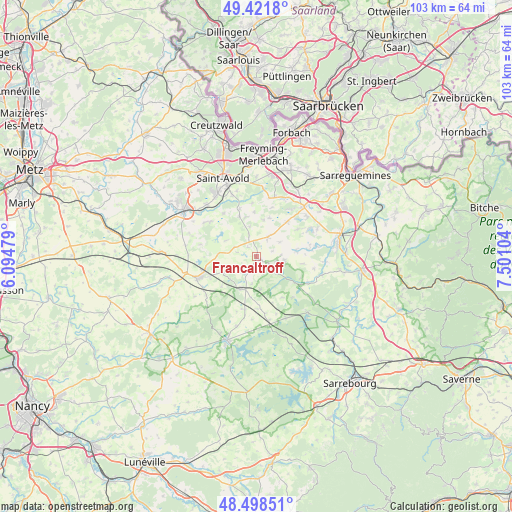
Francaltroff GPS coordinates[2]
48° 57' 44.244" North, 6° 47' 52.512" East
| Map corner | latitude | longitude |
|---|---|---|
| Upper-left | 49.4218°, | 6.09479° |
| Center: | 48.96229°, | 6.79792° |
| Lower-right: | 48.49851°, | 7.50104° |
| Map W x H: | 102.7×102.7 km | = 63.8×63.8mi |
| max Lat: | 51.07786° ⇑21.2% North |
| Francaltroff: | 48.96229° |
| min Lat: | ⇓78.8% South 41.3874° |
| min Long | Francaltroff | max Long |
| -5.08615° | 6.79792° | 9.52242° |
| W 93.6%⇐ | ⇒6.4% E |
Elevation
Elevation of Francaltroff is 232 m = 761 ft, and this is 38.3 m = 126 ft above average elevation for this country.
| Max E: |
2333 m = 7654 ft | 27.6% |
| Francaltroff | 232 m 761 ft | |
| Avg. | 193.7 m = 635 ft | |
Min E: |
-1 m = -3 ft | 72.4% |
See also: France elevation on elevation.city.
Geographical zone
Francaltroff is located in North temperate zone (between Tropic of Cancer and the Arctic Circle). Distance of this North polar circle is 1957.1 km =1216.1 mi to North.| Distance of | km | miles | from Francaltroff |
|---|---|---|---|
| North Pole | 4563 | 2835.3 | to North |
| Arctic Circle | 1957.1 | 1216.1 | to North |
| Tropic Cancer | 2838.2 | 1763.6 | to South |
| Equator | 5444.1 | 3382.8 | to South |


Nearby cities:
15 places around Francaltroff: (largest is in red/bold)
• Albestroff
5.4 km =3.4 mi,  127°
127°
• Barst
12.1 km =7.5 mi,  12°
12°
• Bénestroff
7 km =4.3 mi,  203°
203°
• Grostenquin
4.7 km =2.9 mi,  294°
294°
• Guessling-Hémering
12.3 km =7.6 mi,  304°
304°
• Hellimer
4.5 km =2.8 mi,  30°
30°
• Hilsprich
10.3 km =6.4 mi,  56°
56°
• Insming
5.7 km =3.5 mi,  97°
97°
• Laning
8.3 km =5.2 mi,  347°
347°
• Le Val-de-Guéblange
12.2 km =7.6 mi,  80°
80°
• Lixing-lès-Saint-Avold
8.9 km =5.5 mi,  337°
337°
• Morhange
12.2 km =7.6 mi,  249°
249°
• Racrange
10.2 km =6.3 mi, 246°
• Saint-Jean-Rohrbach
9.5 km =5.9 mi,  41°
41°
• Vahl-Ebersing
10.2 km =6.3 mi, 341°
Sources, notices
• [Note1] Compared only with cities in France existing in our database
• [Src1] Map data: © OpenStreetMap contributors (CC-BY-SA)
• [Src2] Other city data from geonames.org with taken over terms of usage.
• [Src3] Geographical zone / Annual Mean Temperature by Robert A. Rohde @ Wikipedia
